Area Overview for BL9 6LL
Photos of BL9 6LL
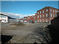
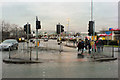
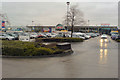
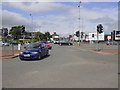

88 photos from this area
Area Information
Key information about the BL9 6LL including its size, population, and administrative classification.
- Area Type
- Postcode
- Area Size
- 1.5 hectares
- Population
- 1812
- Population Density
- 2672 people/km²
House Prices in BL9 6LL
100
Properties
£153,111
Average Sold Price
£44,500
Lowest Price
£270,000
Highest Price
Showing 100 properties
| Address | Type | Beds | Baths | Last Sale Price | Last Sale Date | |
|---|---|---|---|---|---|---|
| 206 Walmersley Road, Bury, BL9 6LL | Terraced | 6 | 2 | £270,000 | Dec 2021 | |
| 142 Walmersley Road, Bury, BL9 6LL | house | - | - | £159,995 | Nov 2020 | |
| 146 Walmersley Road, Bury, BL9 6LL | house | 5 | - | £149,500 | Feb 2019 | |
| 208 Walmersley Road, Bury, BL9 6LL | Terraced | 5 | 1 | £185,000 | Mar 2016 | |
| 148 Walmersley Road, Bury, BL9 6LL | house | - | - | £188,000 | May 2011 | |
| 154 Walmersley Road, Bury, BL9 6LL | Terraced | 7 | 3 | £160,000 | May 2008 | |
| 138 Walmersley Road, Bury, BL9 6LL | house | - | - | £167,000 | May 2006 | |
| 162 Walmersley Road, Bury, BL9 6LL | house | - | - | £54,000 | Nov 2001 | |
| 160 Walmersley Road, Bury, BL9 6LL | house | - | - | £44,500 | Jan 2001 | |
| 156 Walmersley Road, Bury, BL9 6LL | Terraced | 6 | 1 | - | - |
Page 1 of 10
Energy Efficiency in BL9 6LL
Amenities
Schools
| Rank | School | Type | Entry gender | Ages |
|---|
Explore more schools in this area
Go to Schools tabDemographics
Household Size
Family (3-5 people)
most common
Accommodation Type
Houses
most common
Tenure
37
majority
Ethnic Group
White
most common
Religion
N/A
most common
Household Composition
N/A
most common
Age
47
median
Adults (30-64 years)
most common
Household Deprivation
N/A
with no deprivation
NS-SEC
12
in Lower managerial occupations
Explore more demographic insights in this area
Go to Demographics tabPlanning
Planning Constraints
- Flood RiskPremium
- Ramsar Wetland SitesPremium
- Area of Outstanding Natural BeautyPremium
- Protected Nature ReservePremium
- Protected WoodlandPremium