Area Overview for BL9 0DB
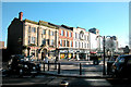
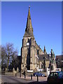
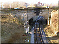
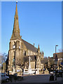
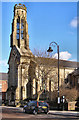
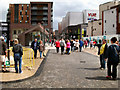
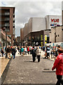
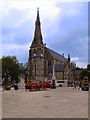
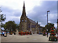
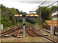
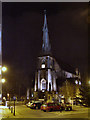
Photos of BL9 0DB
Area Information
BL9 0DB is a small, densely populated postcode area in England, covering just 1.2 hectares and home to 1,862 residents. Situated in the Redvales district, it lies south of Bury town centre, bordered by Manchester Road, the River Irwell, and thoroughfares like Radcliffe Road. This residential cluster blends suburban character with historical roots, including a 19th-century workhouse and former golf club land. The area’s compact size means it is tightly integrated with Bury’s broader infrastructure, offering proximity to town amenities while retaining a distinct, low-density feel. Daily life here is shaped by its proximity to transport hubs, retail outlets, and educational institutions. The population density of 152,283 people per square kilometre reflects a tightly knit community, though the area’s small footprint means it is more of a micro-precinct than a sprawling suburb. For buyers, BL9 0DB represents a compact, high-density living option with direct access to Bury’s services, albeit in a space where every home is within close reach of its neighbours.
- Area Type
- Postcode
- Area Size
- 1.2 hectares
- Population
- 1862
- Population Density
- 2710 people/km²
BL9 0DB is a small area where 58% of properties are owner-occupied, suggesting a stable housing market with a focus on long-term residency rather than transient rental demand. The accommodation type is predominantly houses, which, given the area’s size, likely includes semi-detached or terraced homes. This contrasts with larger urban areas where flats dominate, and it aligns with the suburban character of Redvales. The compact nature of the postcode means that property choices are limited to a small cluster, making it a niche market for buyers seeking proximity to Bury’s amenities. The high population density—152,283 people per square kilometre—suggests that properties here are likely to be in close proximity to one another, potentially limiting privacy or outdoor space. For buyers, this area may appeal to those prioritising convenience over expansive living space.
House Prices in BL9 0DB
No properties found in this postcode.
Energy Efficiency in BL9 0DB
Living in BL9 0DB offers access to a range of amenities within walking distance or a short drive. The area is served by five retail outlets, including Heron Bury and Asda, providing everyday shopping options. Metro stops such as Bury Interchange and Bury Bolton Street offer connections to local services and transport links. Railway stations like Kearsley and Clifton provide access to broader regional networks. While the area lacks detailed information on parks or leisure facilities, its proximity to Bury town centre suggests access to larger green spaces and cultural amenities. The compact nature of BL9 0DB means that daily life is centred around its immediate surroundings, with a focus on convenience and accessibility. For residents, this translates to a lifestyle where essential services are close at hand, though the absence of specific data on parks or recreational facilities leaves some aspects of leisure life unexplored.
Amenities
Schools
BL9 0DB is served by a range of independent and sixth-form schools, including Bury Catholic Preparatory School, Bury Grammar Schools, and Bury Grammar School Girls. These institutions cater to primary and secondary education, with sixth-form colleges like Bury College and Holy Cross College providing further education options. The presence of multiple independent schools suggests a focus on private education, which may attract families prioritising academic or specialist curricula. However, the absence of state schools in the data means the educational landscape here is entirely private. For families, this offers a choice of high-quality, fee-paying education but may also imply higher costs compared to areas with state-funded options. The mix of school types ensures coverage from early years through to post-16 education, though buyers should verify whether these institutions are within walking distance of specific properties.
| Rank | School | Type | Entry gender | Ages |
|---|
Explore more schools in this area
Go to Schools tabDemographics
The population of BL9 0DB has a median age of 47, with the majority of residents aged 30–64 years. This suggests a community skewed towards middle-aged adults, likely including professionals, families, and retirees. Home ownership rates stand at 58%, indicating a mix of owner-occupied and rental properties, though the exact proportion of rentals is not specified. The area is predominantly composed of houses, which, combined with the high population density, implies a concentration of semi-detached or terraced housing. The predominant ethnic group is White, reflecting broader demographic trends in Greater Manchester. The high population density, while enabling a vibrant local community, may also contribute to a sense of intimacy and shared space. However, the absence of specific data on deprivation or income levels means the full picture of quality of life remains partially obscured.
Household Size
Accommodation Type
Tenure
Ethnic Group
Religion
Household Composition
Age
Household Deprivation
NS-SEC
Explore more demographic insights in this area
Go to Demographics tabPlanning
Planning Constraints
- Flood RiskPremium
- Ramsar Wetland SitesPremium
- Area of Outstanding Natural BeautyPremium
- Protected Nature ReservePremium
- Protected WoodlandPremium