Area Overview for BL7 8AF
Photos of BL7 8AF
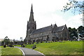


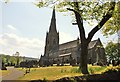
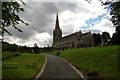
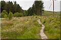
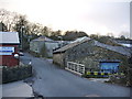
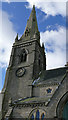
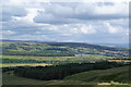
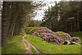
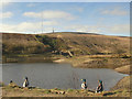
100 photos from this area
Area Information
Key information about the BL7 8AF including its size, population, and administrative classification.
- Area Type
- Postcode
- Area Size
- 1.2 hectares
- Population
- 1158
- Population Density
- 35 people/km²
House Prices in BL7 8AF
15
Properties
£276,050
Average Sold Price
£92,500
Lowest Price
£962,500
Highest Price
Showing 15 properties
| Address | Type | Beds | Baths | Last Sale Price | Last Sale Date | |
|---|---|---|---|---|---|---|
| 22 High Street, Belmont, Bolton, BL7 8AF | Terraced | 2 | 1 | £165,000 | Dec 2024 | |
| 36 High Street, Belmont, Bolton, BL7 8AF | Cottage | 2 | 1 | £175,000 | Mar 2023 | |
| 28 High Street, Belmont, Bolton, BL7 8AF | Cottage | 2 | 1 | £190,000 | Aug 2022 | |
| 30 High Street, Belmont, Bolton, BL7 8AF | Cottage | 2 | 1 | £166,000 | Dec 2020 | |
| Ryecroft House, High Street, Belmont, Bolton, BL7 8AF | Detached | 5 | 3 | £962,500 | Aug 2017 | |
| 18 High Street, Belmont, Bolton, BL7 8AF | Detached | 5 | 2 | £325,000 | Aug 2016 | |
| 40 High Street, Belmont, Bolton, BL7 8AF | Cottage | 2 | - | £150,000 | May 2015 | |
| The Old Parish Hall, High Street, Belmont, Bolton, BL7 8AF | Bungalow | - | - | £357,500 | Feb 2014 | |
| 32 High Street, Belmont, Bolton, BL7 8AF | house | - | - | £92,500 | Apr 2003 | |
| 46 High Street, Belmont, Bolton, BL7 8AF | Cottage | 4 | 3 | £177,000 | May 2001 |
Page 1 of 2
Energy Efficiency in BL7 8AF
Amenities
Schools
| Rank | School | Type | Entry gender | Ages |
|---|
Explore more schools in this area
Go to Schools tabDemographics
Household Size
Two person
most common
Accommodation Type
Houses
most common
Tenure
89
majority
Ethnic Group
White
most common
Religion
N/A
most common
Household Composition
N/A
most common
Age
47
median
Adults (30-64 years)
most common
Household Deprivation
N/A
with no deprivation
NS-SEC
47
in Lower managerial occupations
Explore more demographic insights in this area
Go to Demographics tabPlanning
Planning Constraints
- Flood RiskPremium
- Ramsar Wetland SitesPremium
- Area of Outstanding Natural BeautyPremium
- Protected Nature ReservePremium
- Protected WoodlandPremium