Area Overview for BL7 8AD
Photos of BL7 8AD
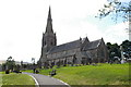


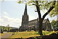
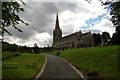
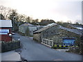

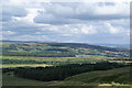
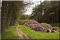
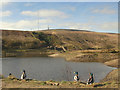
100 photos from this area
Area Information
Key information about the BL7 8AD including its size, population, and administrative classification.
- Area Type
- Postcode
- Area Size
- 6.8 hectares
- Population
- 1158
- Population Density
- 35 people/km²
House Prices in BL7 8AD
8
Properties
£450,819
Average Sold Price
£230,000
Lowest Price
£840,000
Highest Price
Showing 8 properties
| Address | Type | Beds | Baths | Last Sale Price | Last Sale Date | |
|---|---|---|---|---|---|---|
| Stonelea, 24 Rivington Road, Belmont, Bolton, BL7 8AD | Detached | 6 | 5 | £800,000 | Nov 2021 | |
| Moorview, 28 Rivington Road, Belmont, Bolton, BL7 8AD | Detached | 6 | 6 | £840,000 | Jun 2021 | |
| 20 Rivington Road, Belmont, Bolton, BL7 8AD | Semi-detached | 3 | 1 | £352,050 | Jun 2021 | |
| Hordern Cottage, Rivington Road, Belmont, Bolton, BL7 8AD | Detached | 5 | 2 | £402,000 | May 2019 | |
| 14 Rivington Road, Belmont, Bolton, BL7 8AD | Detached | 2 | 1 | £282,500 | Jan 2018 | |
| Beechwood, 22 Rivington Road, Belmont, Bolton, BL7 8AD | house | - | - | £340,000 | May 2012 | |
| 16 Rivington Road, Belmont, Bolton, BL7 8AD | Detached | - | - | £360,000 | Dec 2006 | |
| 18 Rivington Road, Belmont, Bolton, BL7 8AD | Semi-detached | - | - | £230,000 | Nov 2003 |
Energy Efficiency in BL7 8AD
Amenities
Schools
| Rank | School | Type | Entry gender | Ages |
|---|
Explore more schools in this area
Go to Schools tabDemographics
Household Size
Two person
most common
Accommodation Type
Houses
most common
Tenure
89
majority
Ethnic Group
White
most common
Religion
N/A
most common
Household Composition
N/A
most common
Age
47
median
Adults (30-64 years)
most common
Household Deprivation
N/A
with no deprivation
NS-SEC
47
in Lower managerial occupations
Explore more demographic insights in this area
Go to Demographics tabPlanning
Planning Constraints
- Flood RiskPremium
- Ramsar Wetland SitesPremium
- Area of Outstanding Natural BeautyPremium
- Protected Nature ReservePremium
- Protected WoodlandPremium