Area Overview for BL7 0JF
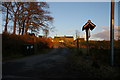
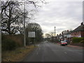
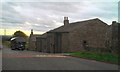
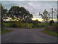
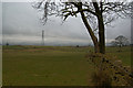
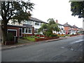
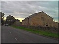
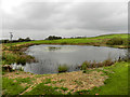
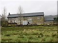
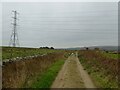
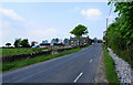
Photos of BL7 0JF

Area Information
BL7 0JF is a small residential postcode area in North Turton, Lancashire, encompassing 16 hectares and home to approximately 1,902 residents. Situated historically within the township of Turton, this area lies between Bolton and Blackburn, reflecting its roots in the ancient parish of Bolton le Moors. The population density of 66 people per square kilometre suggests a low-density, spacious living environment, typical of rural or semi-rural settings. Daily life here is shaped by its compact size and proximity to nearby towns. With a median age of 47 and a majority of residents aged 30–64, the community is predominantly composed of established adults, many of whom own their homes. The area’s small scale means residents are likely to know their neighbours, fostering a close-knit atmosphere. While BL7 0JF lacks major urban amenities, its strategic location near rail and metro stations offers connectivity to larger centres. This blend of quiet living and accessibility makes it appealing for those seeking a balance between tranquillity and convenience.
- Area Type
- Postcode
- Area Size
- 16.0 hectares
- Population
- 1902
- Population Density
- 66 people/km²
BL7 0JF is characterised by a strong owner-occupied market, with 85% of homes owned by residents rather than rented. The area’s housing stock consists predominantly of houses, reflecting a focus on family homes and single-dwelling properties. This contrasts with areas where flats or apartments dominate, and it suggests a preference for traditional, detached or semi-detached residences. The small size of the postcode area means the property market is limited in scope, with few options available within BL7 0JF itself. Buyers may need to consider nearby postcodes for more variety. The high home ownership rate indicates a stable, long-term resident base, which can be advantageous for those seeking a settled community. However, the limited housing stock may also lead to higher competition for available properties. For buyers, this means prioritising location and condition, as the area’s small size offers few alternatives.
House Prices in BL7 0JF
Showing 16 properties
| Address | Type | Beds | Baths | Last Sale Price | Last Sale Date | |
|---|---|---|---|---|---|---|
| Sandygates, Broadhead Road, Turton, Bolton, BL7 0JF | house | - | - | £975,000 | Jun 2014 | |
| 2, Wadhams Court, Broadhead Road, Edgworth, Bolton, BL7 0JF | Flat | 2 | 1 | - | - | |
| 11, Wadhams Court, Broadhead Road, Turton, Bolton, BL7 0JF | Flat | 2 | 1 | - | - | |
| 9, Wadhams Court, Broadhead Road, Turton, Bolton, BL7 0JF | Flat | 2 | 1 | - | - | |
| 10, Wadhams Court, Broadhead Road, Turton, Bolton, BL7 0JF | Flat | 2 | 1 | - | - | |
| 5, Wadhams Court, Broadhead Road, Turton, Bolton, BL7 0JF | Flat | 2 | 1 | - | - | |
| 1, Pleasant View, Broadhead Road, Turton, Bolton, BL7 0JF | Retail | 5 | 3 | - | - | |
| 6, Wadhams Court, Broadhead Road, Turton, Bolton, BL7 0JF | Flat | 2 | 1 | - | - | |
| 8, Wadhams Court, Broadhead Road, Turton, Bolton, BL7 0JF | Flat | 2 | 1 | - | - | |
| 4, Wadhams Court, Broadhead Road, Turton, Bolton, BL7 0JF | Flat | - | - | - | - |
Energy Efficiency in BL7 0JF
The lifestyle in BL7 0JF is shaped by its proximity to essential amenities, including retail and transport hubs. Five retail outlets, such as Co-op Holcombe, Spar, and Co-op Bromley, provide access to groceries and everyday necessities. The area’s rail and metro stations—Entwistle, Bromley Cross, Darwen, Ramsbottom, and others—ensure residents can easily reach larger towns for work, leisure, or shopping. While the postcode itself is small, the surrounding area offers a practical balance of local convenience and regional access. The lack of detailed data on parks or leisure facilities means the full extent of recreational options is unclear, but the presence of nearby towns suggests opportunities for cultural or outdoor activities. For daily life, the combination of local shops and transport links supports a functional, low-maintenance lifestyle, ideal for those valuing accessibility without urban overcrowding.
Amenities
Schools
The schools near BL7 0JF cater to a range of educational needs, with a mix of primary and special schools. Turton and Edgworth CofE/Methodist Controlled Primary School is a primary institution with a ‘good’ Ofsted rating, providing a solid foundation for younger children. Crowthorn School and Lower Pastures, both special schools, also hold ‘good’ ratings, indicating they meet high standards in supporting students with specific learning needs. This combination of school types ensures families have options for both mainstream and specialist education. The presence of special schools suggests the area accommodates a diverse range of household needs, including those with children requiring tailored support. While no secondary schools are listed, the proximity to larger towns like Blackburn and Bolton likely provides access to more comprehensive educational facilities. For families, the availability of rated schools within practical reach is a key consideration.
| Rank | School | Type | Entry gender | Ages |
|---|
Explore more schools in this area
Go to Schools tabDemographics
The demographic profile of BL7 0JF reflects a mature, stable population. With a median age of 47 and 85% of residents owning their homes, the area is dominated by households in the 30–64 age range. This suggests a community of long-term residents, many of whom may be in their prime working years or approaching retirement. The predominant accommodation type is houses, indicating a lack of high-density housing or flats. The majority of the population identifies as White, though no specific data on minority representation is provided. The low population density of 66 people per square kilometre implies spacious living conditions, which could be a draw for those prioritising privacy. However, the absence of detailed diversity statistics means the full extent of the community’s social composition remains unclear. The high home ownership rate suggests economic stability, though it also limits rental availability, potentially affecting affordability for newcomers.
Household Size
Accommodation Type
Tenure
Ethnic Group
Religion
Household Composition
Age
Household Deprivation
NS-SEC
Explore more demographic insights in this area
Go to Demographics tabPlanning
Planning Constraints
- Flood RiskPremium
- Ramsar Wetland SitesPremium
- Area of Outstanding Natural BeautyPremium
- Protected Nature ReservePremium
- Protected WoodlandPremium