Area Overview for BL7 0JD
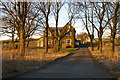
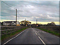
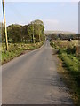
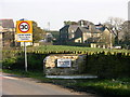
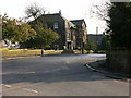
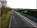
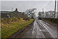
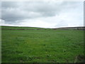
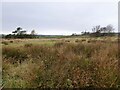
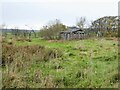
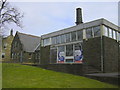
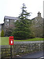
Photos of BL7 0JD
Area Information
Living in BL7 0JD offers a quiet, compact residential experience in the heart of North Turton, a civil parish in Lancashire. With a population of 1,902 spread across 1.2 hectares, the area feels intimate, fostering a sense of close-knit community. Historically part of the township of Turton, this postcode sits between Bolton and Blackburn, blending rural charm with accessible connectivity. Daily life here is shaped by its proximity to local amenities, including five nearby railway stations and a range of retail outlets. The area’s low crime risk and absence of environmental constraints make it appealing for families and retirees alike. While small in size, BL7 0JD is strategically positioned near key transport links, such as the Entwistle and Darwen stations, offering easy access to surrounding towns. The presence of schools, including a primary school with a good Ofsted rating, adds to its appeal for households prioritising education. For those seeking a peaceful yet practical location, BL7 0JD balances seclusion with convenience.
- Area Type
- Postcode
- Area Size
- 1.2 hectares
- Population
- 1902
- Population Density
- 66 people/km²
BL7 0JD is characterised by a strong owner-occupied market, with 85% of homes owned by residents rather than rented. The accommodation type is exclusively houses, suggesting a lack of high-density housing or rental properties. This composition likely appeals to buyers seeking traditional, spacious homes in a stable, low-risk area. The small size of the postcode—just 1.2 hectares—means the housing stock is limited, potentially making the area competitive for buyers. However, the proximity to nearby towns such as Ramsbottom and Rawtenstall via metro links may expand options for those willing to consider adjacent areas. The absence of planning constraints or environmental restrictions also makes BL7 0JD an attractive prospect for those prioritising ease of development or investment. For buyers, the focus on owner-occupation and single-family homes indicates a market skewed towards long-term residency rather than transient renters.
House Prices in BL7 0JD
Showing 5 properties
| Address | Type | Beds | Baths | Last Sale Price | Last Sale Date | |
|---|---|---|---|---|---|---|
| 4, The Schoolhouse, Crowthorn Road, Edgworth, Bolton, BL7 0JD | Semi-detached | 4 | 3 | £462,500 | Oct 2020 | |
| 5, The Schoolhouse, Crowthorn Road, Edgworth, Bolton, BL7 0JD | Terraced | 5 | 2 | £340,000 | Dec 2014 | |
| 3, The Schoolhouse, Crowthorn Road, Edgworth, Bolton, BL7 0JD | Semi-detached | 3 | 2 | £390,000 | Sep 2012 | |
| 2, The Schoolhouse, Crowthorn Road, Edgworth, Bolton, BL7 0JD | Semi-detached | 3 | 2 | - | - | |
| 1, The Schoolhouse, Crowthorn Road, Edgworth, Bolton, BL7 0JD | house | - | - | - | - |
Energy Efficiency in BL7 0JD
The lifestyle in BL7 0JD is shaped by its access to nearby amenities, which include five railway stations, five retail outlets, and three metro stops. The Co-op Holcombe and Morrisons Shuttleworth cater to daily shopping needs, while the railway stations at Entwistle and Darwen provide links to broader transport networks. For leisure, the area’s proximity to towns like Ramsbottom and Rawtenstall offers additional dining, cultural, and recreational opportunities. The presence of multiple retail points ensures convenience for residents, though the small size of the postcode means the core area itself lacks large-scale facilities. The mix of transport options and local shops supports a practical, low-maintenance lifestyle, ideal for those prioritising accessibility over sprawling urban amenities. The compact nature of BL7 0JD encourages a focus on nearby towns for more extensive services, creating a balanced approach to daily living.
Amenities
Schools
BL7 0JD is served by three schools, each catering to different educational needs. Turton and Edgworth CofE/Methodist Controlled Primary School offers primary education with a good Ofsted rating, ensuring a solid foundation for younger children. For special needs education, Crowthorn School and Lower Pastures School provide tailored support, with the latter also holding a good Ofsted rating. This mix of school types ensures families have options for both mainstream and specialist education. The presence of a primary school with a strong rating is particularly valuable for households with young children, while the special schools address the needs of students with additional requirements. The diversity in school provision reflects the area’s commitment to inclusive education, though the absence of secondary schools may necessitate commuting to nearby towns for older students.
| Rank | School | Type | Entry gender | Ages |
|---|
Explore more schools in this area
Go to Schools tabDemographics
BL7 0JD’s population skews towards adults aged 30–64, with a median age of 47, reflecting a mature community. Home ownership is high, at 85%, indicating long-term residency and stability. The area is predominantly composed of houses, with no data on flats or other property types. The majority of residents identify as White, though specific diversity metrics are not provided. The low population density of 66 people per square kilometre suggests spacious living conditions for the number of residents. This demographic profile aligns with a community focused on family life and established neighbourhoods. The absence of detailed deprivation data means quality of life factors such as access to services or economic hardship are not explicitly quantified, but the high home ownership rate and low crime risk imply a relatively secure and self-sufficient environment.
Household Size
Accommodation Type
Tenure
Ethnic Group
Religion
Household Composition
Age
Household Deprivation
NS-SEC
Explore more demographic insights in this area
Go to Demographics tabPlanning
Planning Constraints
- Flood RiskPremium
- Ramsar Wetland SitesPremium
- Area of Outstanding Natural BeautyPremium
- Protected Nature ReservePremium
- Protected WoodlandPremium