Area Overview for BL7 0EN
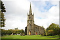
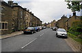
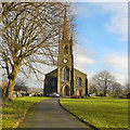
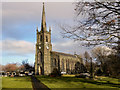
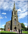
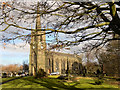
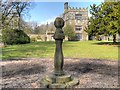
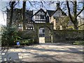
Photos of BL7 0EN
Area Information
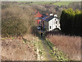
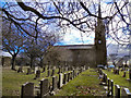
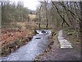
BL7 0EN is a small residential postcode area in England, covering 2.6 hectares and home to 1,902 residents. Situated in North Turton, historically part of Bolton le Moors, it lies between Blackburn and Bolton, at coordinates 53.63864122623419, -2.3963248467178553. The area is a civil parish with a low population density of 66 people per square kilometre, suggesting a spread-out, quiet residential character. Daily life here is shaped by its rural-adjacent setting, with proximity to nearby towns offering employment and services. The area’s history as a township with chapels dating to the 12th century adds a layer of heritage, though modern living is focused on local amenities and transport links. BL7 0EN is ideal for those seeking a peaceful, low-density environment with access to nearby urban centres for work or shopping. Its compact size means residents are likely to know their neighbours, fostering a close-knit community feel.
- Area Type
- Postcode
- Area Size
- 2.6 hectares
- Population
- 1902
- Population Density
- 66 people/km²
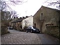
BL7 0EN is predominantly an owner-occupied area, with 85% of homes owned by residents rather than rented. The accommodation type is exclusively houses, which is unusual for a small postcode area but aligns with its low population density of 66 people per square kilometre. This suggests a focus on standalone properties with private gardens, typical of suburban or rural-adjacent settings. Given the area’s small size, the housing stock is limited, meaning buyers may need to consider nearby postcode areas for more options. The high home ownership rate indicates a market where long-term residency is common, and properties are likely to be well-maintained. For buyers, this means a potentially stable market with fewer speculative investments, though the limited supply could make competition for available homes more intense.
House Prices in BL7 0EN
Showing 1 properties
| Address | Type | Beds | Baths | Last Sale Price | Last Sale Date | |
|---|---|---|---|---|---|---|
| St Annes School House, High Street, Chapeltown, Bolton, BL7 0EN | Detached | - | - | - | - |
Energy Efficiency in BL7 0EN
The lifestyle in BL7 0EN is shaped by its proximity to retail, transport, and community hubs. Five retail outlets, including Co-op Bromley and Sainsburys Bolton, provide essential shopping options within reach. The area’s rail and metro connections, such as Entwistle Railway Station and Bury Interchange, offer easy access to nearby towns for work, leisure, or socialising. While the area itself is small, its integration with surrounding postcode areas ensures a broader range of amenities. The low population density and quiet residential character suggest a relaxed pace of life, with opportunities for outdoor activities in nearby green spaces. For families, the mix of schools and transport links creates a balance between local convenience and regional connectivity. The area’s compact size means amenities are close, fostering a sense of community without sacrificing accessibility.
Amenities
Schools
BL7 0EN is served by three schools, each catering to different educational needs. Turton and Edgworth CofE/Methodist Controlled Primary School is a primary school with a good Ofsted rating, offering a solid foundation for younger children. Crowthorn School and Lower Pastures are both special schools, indicating the area’s capacity to support students with specific learning requirements. The presence of both primary and special schools provides families with a range of options, ensuring accessibility for children with diverse educational needs. The good Ofsted rating at Turton and Edgworth suggests a reliable primary education, while the special schools highlight the area’s commitment to inclusive learning. Families with children requiring tailored support may find this mix of schools particularly advantageous.
| Rank | School | Type | Entry gender | Ages |
|---|
Explore more schools in this area
Go to Schools tabDemographics
The population of BL7 0EN has a median age of 47, with the majority of residents aged 30–64 years. This suggests a mature, stable community with a strong presence of middle-aged adults. Home ownership is high at 85%, indicating a predominance of owner-occupied properties rather than rentals. The accommodation type is primarily houses, which aligns with the area’s low density and suburban character. The predominant ethnic group is White, reflecting the demographic profile of the broader North West England region. With 66 people per square kilometre, the area is sparsely populated, contributing to a quieter, less congested lifestyle. This density also implies that residents may have more private outdoor space compared to denser urban areas. The age profile and home ownership figures suggest a community that values stability and long-term residency over transient living.
Household Size
Accommodation Type
Tenure
Ethnic Group
Religion
Household Composition
Age
Household Deprivation
NS-SEC
Explore more demographic insights in this area
Go to Demographics tabPlanning
Planning Constraints
- Flood RiskPremium
- Ramsar Wetland SitesPremium
- Area of Outstanding Natural BeautyPremium
- Protected Nature ReservePremium
- Protected WoodlandPremium