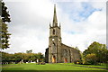
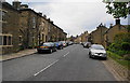
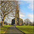
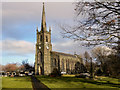
Area Overview for BL7 0EG
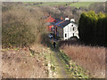
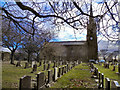
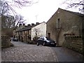
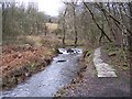
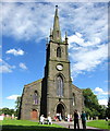
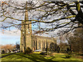
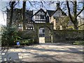
Photos of BL7 0EG
Area Information
BL7 0EG is a small, residential postcode area in North Turton, England, covering just 2.1 hectares and home to 1,902 residents. Its compact size means it is a tightly knit community, with a population density of 66 people per square kilometre. Situated historically within the township of Turton, this area has roots in the ancient parish of Bolton le Moors, with records dating back to the 12th century. Today, it reflects a stable, mature demographic, with a median age of 47 and a strong presence of adults aged 30–64. Daily life here is characterised by a mix of local amenities, including nearby railway stations, retail outlets, and schools. The area’s proximity to major transport links, such as Entwistle and Bromley Cross stations, makes it accessible for commuters. While the broadband quality is poor, mobile coverage is strong, supporting connectivity for most needs. BL7 0EG is a quiet, low-risk area with no significant environmental constraints, offering a blend of historical heritage and modern convenience for those seeking a settled lifestyle.
- Area Type
- Postcode
- Area Size
- 2.1 hectares
- Population
- 1902
- Population Density
- 66 people/km²
BL7 0EG is an owner-occupied area, with 85% of homes in private ownership. The accommodation type is predominantly houses, suggesting a focus on family-friendly properties rather than rental units or smaller dwellings. This composition indicates a community of long-term residents, likely with established roots in the area. The small size of the postcode area—just 2.1 hectares—means the housing stock is limited, with no indication of high-density development. Buyers should consider nearby areas for more options, though the existing stock may offer characterful, traditional homes. The high home ownership rate also implies strong local ties, which can be appealing for those seeking a sense of community. However, the limited scale of the area may mean competition for available properties, particularly for those prioritising proximity to specific amenities.
House Prices in BL7 0EG
Showing 20 properties
| Address | Type | Beds | Baths | Last Sale Price | Last Sale Date | |
|---|---|---|---|---|---|---|
| 29 Wellington Road, Turton, Bolton, BL7 0EG | house | 3 | 1 | £275,000 | Jun 2025 | |
| 9 Wellington Road, Turton, Bolton, BL7 0EG | Terraced | 2 | 2 | £262,500 | Apr 2025 | |
| 2 Wellington Road, Turton, Bolton, BL7 0EG | Retail | - | - | £90,000 | Feb 2023 | |
| 7 Wellington Road, Turton, Bolton, BL7 0EG | house | 3 | 2 | £275,000 | May 2022 | |
| 5 Wellington Road, Turton, Bolton, BL7 0EG | Terraced | 4 | 1 | £290,000 | May 2022 | |
| 13 Wellington Road, Turton, Bolton, BL7 0EG | house | - | - | £180,000 | Sep 2021 | |
| 17 Wellington Road, Turton, Bolton, BL7 0EG | Terraced | 3 | 2 | £122,500 | Mar 2016 | |
| 27 Wellington Road, Turton, Bolton, BL7 0EG | Terraced | 2 | 1 | £120,000 | Oct 2015 | |
| 25 Wellington Road, Turton, Bolton, BL7 0EG | Terraced | 2 | 1 | £129,000 | Nov 2014 | |
| 23 Wellington Road, Turton, Bolton, BL7 0EG | Terraced | 3 | - | £198,900 | Oct 2014 |
Energy Efficiency in BL7 0EG
Residents of BL7 0EG enjoy a mix of local shops, transport hubs, and community services. Nearby retail options include Co-op Bromley, Sainsburys Bolton, and Spar, providing convenience for daily essentials. The area’s proximity to five railway stations—such as Entwistle and Bromley Cross—offers easy access to regional transport networks, while metro stops at Ramsbottom and Bury Interchange connect to larger cities. For leisure, the historical and cultural context of North Turton adds depth to the local character, though specific parks or recreational facilities are not detailed in the data. The presence of multiple schools and low crime risk contributes to a family-friendly environment. While the broadband quality is poor, mobile coverage is strong, supporting connectivity for most needs. Overall, the area balances practical amenities with a quiet, low-risk setting, ideal for those prioritising convenience and stability.
Amenities
Schools
Residents of BL7 0EG have access to a range of educational institutions, including Turton and Edgworth CofE/Methodist Controlled Primary School, which holds a ‘good’ Ofsted rating. This primary school serves the local community, offering a solid foundation for young learners. Two special schools are also nearby: Crowthorn School and Lower Pastures, both of which cater to students with specific educational needs. The presence of both mainstream and specialist schools suggests a comprehensive approach to education, accommodating diverse requirements. For families, this mix ensures options for both general and tailored learning environments. While no secondary schools are listed in the data, the proximity to larger towns like Blackburn and Bolton likely provides additional schooling choices. The quality of local education, particularly the primary school’s rating, is a key factor for families considering the area.
| Rank | School | Type | Entry gender | Ages |
|---|
Explore more schools in this area
Go to Schools tabDemographics
The community in BL7 0EG is predominantly composed of adults aged 30–64, reflecting a mature, stable population with a median age of 47. Home ownership is high, with 85% of residents living in owner-occupied properties, suggesting long-term residency and investment in the area. The accommodation type is primarily houses, indicating a focus on family homes rather than flats or apartments. The predominant ethnic group is White, though specific data on diversity or deprivation is not provided. The population density of 66 people per square kilometre means the area is neither overcrowded nor sparse, supporting a balanced community feel. With no significant data on deprivation, it is reasonable to infer that the area’s low crime risk and lack of environmental constraints contribute to a quality of life that appeals to those prioritising safety and stability.
Household Size
Accommodation Type
Tenure
Ethnic Group
Religion
Household Composition
Age
Household Deprivation
NS-SEC
Explore more demographic insights in this area
Go to Demographics tabPlanning
Planning Constraints
- Flood RiskPremium
- Ramsar Wetland SitesPremium
- Area of Outstanding Natural BeautyPremium
- Protected Nature ReservePremium
- Protected WoodlandPremium