Area Overview for BL6 5PJ
Photos of BL6 5PJ
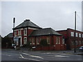
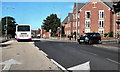
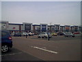
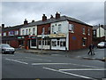
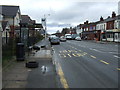
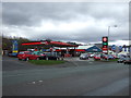
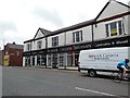
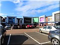
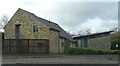
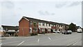
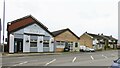
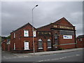
21 photos from this area
Area Information
Key information about the BL6 5PJ including its size, population, and administrative classification.
- Area Type
- Postcode
- Area Size
- 1.4 hectares
- Population
- 1760
- Population Density
- 3647 people/km²
House Prices in BL6 5PJ
27
Properties
£103,150
Average Sold Price
£5,000
Lowest Price
£188,000
Highest Price
Showing 27 properties
| Address | Type | Beds | Baths | Last Sale Price | Last Sale Date | |
|---|---|---|---|---|---|---|
| 193 Victoria Road, Horwich, Bolton, BL6 5PJ | Terraced | 2 | 1 | £167,500 | Nov 2024 | |
| 175 Victoria Road, Horwich, Bolton, BL6 5PJ | Terraced | 2 | 1 | £188,000 | Oct 2024 | |
| 199 Victoria Road, Horwich, Bolton, BL6 5PJ | Terraced | 3 | 1 | £155,000 | Aug 2021 | |
| 195 Victoria Road, Horwich, Bolton, BL6 5PJ | Terraced | 3 | 1 | £147,500 | Mar 2021 | |
| 189 Victoria Road, Horwich, Bolton, BL6 5PJ | Terraced | 2 | 1 | £125,000 | Dec 2020 | |
| 201 Victoria Road, Horwich, Bolton, BL6 5PJ | house | - | - | £5,000 | Oct 2018 | |
| 187 Victoria Road, Horwich, Bolton, BL6 5PJ | Terraced | 3 | 2 | £140,000 | Aug 2016 | |
| 183 Victoria Road, Horwich, Bolton, BL6 5PJ | house | - | - | £143,000 | Jun 2008 | |
| 169 Victoria Road, Horwich, Bolton, BL6 5PJ | house | - | - | £104,000 | Jul 2007 | |
| 171 Victoria Road, Horwich, Bolton, BL6 5PJ | Terraced | 3 | 1 | £95,000 | Apr 2004 |
Page 1 of 3
Energy Efficiency in BL6 5PJ
Amenities
Schools
| Rank | School | Type | Entry gender | Ages |
|---|
Explore more schools in this area
Go to Schools tabDemographics
Household Size
Two person
most common
Accommodation Type
Houses
most common
Tenure
69
majority
Ethnic Group
White
most common
Religion
N/A
most common
Household Composition
N/A
most common
Age
47
median
Adults (30-64 years)
most common
Household Deprivation
N/A
with no deprivation
NS-SEC
38
in Lower managerial occupations
Explore more demographic insights in this area
Go to Demographics tabPlanning
Planning Constraints
- Flood RiskPremium
- Ramsar Wetland SitesPremium
- Area of Outstanding Natural BeautyPremium
- Protected Nature ReservePremium
- Protected WoodlandPremium