Area Overview for BL6 5ER
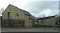
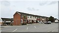
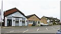
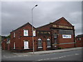
Photos of BL6 5ER
Area Information
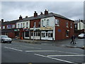
BL6 5ER represents a specific postcode covering a small residential cluster within Horwich, Greater Manchester. This area encompasses 2,578 square metres and houses a population of 1,760 residents. You are looking at a defined pocket of the wider town where daily life plays out on a neighbourhood scale. The location sits at coordinates approximately 53.5935°N, 2.5164°W, placing it firmly in the Metropolitan Borough of Bolton. Originally part of a medieval hunting chase for the Barons of Manchester, Horwich evolved through the 19th century with the arrival of railway workshops that drove significant population growth. While the town gained its charter in 1974 following its move to Greater Manchester, the character of areas like BL6 5ER retains its historic roots. The historic name derives from Old English "har wice," meaning the place at the grey wych-elm, reflecting deep local history despite modern administrative changes. Living here means being part of a community with documented heritage, including listed premises built in the 18th and 19th centuries. You find yourself in an environment where the past and present intersect, defined by the specific boundaries of this postcode rather than broad borough statistics. This residential setting offers a contained community feel typical of small clusters within urban towns.
- Area Type
- Postcode
- Area Size
- 2578 m²
- Population
- 1760
- Population Density
- 3647 people/km²
The housing market in BL6 5ER is characterised by a strong preference for ownership. With 69% of residents owning their homes, this is clearly an owner-occupied area rather than a dynamic rental zone. Houses represent the main accommodation type, meaning you will primarily find single-family dwellings rather than blocks of flats or purpose-built apartments. This profile suggests a stable housing stock where families remain in their properties for extended periods. When you look at the area, expect to see established homes with potential for maintenance and individualisation, typical of the broader Horwich town environment. The small total area size of 2,578 square metres means this postcode contains a limited number of distinct properties, indicating a tightly knit street network. Buying here offers direct access to the established housing stock defined by the region's history. The high home ownership rate signals that investors moving in quickly for short lets are less common. Instead, the market reflects long-term occupants who have chosen this specific location for its residential nature. You are considering buying into a community where the majority of people have already put down roots.
House Prices in BL6 5ER
Showing 8 properties
| Address | Type | Beds | Baths | Last Sale Price | Last Sale Date | |
|---|---|---|---|---|---|---|
| 8 Tansley Close, Horwich, Bolton, BL6 5ER | house | 3 | - | £244,000 | Aug 2023 | |
| 7 Tansley Close, Horwich, Bolton, BL6 5ER | house | 3 | - | £175,000 | Sep 2021 | |
| 6 Tansley Close, Horwich, Bolton, BL6 5ER | Terraced | - | - | £58,750 | Aug 2000 | |
| 1 Tansley Close, Horwich, Bolton, BL6 5ER | Semi-detached | - | - | - | - | |
| 5 Tansley Close, Horwich, Bolton, BL6 5ER | Semi-detached | - | - | - | - | |
| 4 Tansley Close, Horwich, Bolton, BL6 5ER | house | - | - | - | - | |
| 2 Tansley Close, Horwich, Bolton, BL6 5ER | house | - | - | - | - | |
| 3 Tansley Close, Horwich, Bolton, BL6 5ER | Detached | - | - | - | - |
Energy Efficiency in BL6 5ER
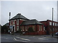
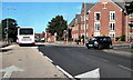
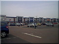
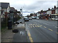
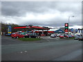
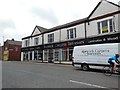
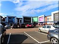
Your daily life in BL6 5ER involves convenient access to several key amenities located within practical reach. For retail needs, five shops serve the local community, including Co-op Chorley, Iceland Horwich, and Aldi Wallsuches. This specific selection ensures you can find essential groceries and general goods without travelling far. Transport connectivity is enhanced by five local railway stations, with Horwich Parkway Railway Station being the most prominent. You can walk to Blackrod Railway Station and Lostock Railway Station as part of your regular commute routine. The area also features notable historic landmarks like Holy Trinity Church, rebuilt in 1831, and the New Chapel, built between 1716 and 1719. These structures are not just buildings but reflect the heritage of Horwich that dates back to its 1221 documentation. The Horwich Town Centre Conservation Area adds to the visual character of your surroundings, offering a sense of place that distinguishes this district from generic urban zones. Living here means having your groceries and transport sorted nearby, while also residing close to protected heritage buildings that define the town's identity.
Amenities
Schools
Families in BL6 5ER have access to a specific selection of educational facilities nearby, though the options are limited in variety. St Mary's RC Primary School and Holy Family RC Primary School both hold 'good' Ofsted ratings, offering secure Catholic education for younger children. You also have Lever Park School and Stocks Park School listed as nearby options. It is important to note that Lever Park School and Stocks Park School are special schools, distinct from the standard primary education provided by the Catholic institutions. This mix means you have two well-rated traditional primary options alongside special education provisions. The presence of multiple special schools in close proximity to BL6 5ER indicates a significant resource for learners with additional needs within the wider Horwich area. However, if you require a standard comprehensive school for secondary education, or a different type of special school, it is not listed in the immediate data set provided. For parents seeking a Catholic primary education with a 'good' rating, the two specific primaries listed are the only confirmed choices in this immediate vicinity. The school landscape is thus a blend of specific denominational primary education and specialist support services.
| Rank | School | Type | Entry gender | Ages |
|---|
Explore more schools in this area
Go to Schools tabDemographics
The demographic profile for BL6 5ER reveals a community dominated by adults aged between 30 and 64 years. The median age across this postcode is 47, indicating a mature population structure. Almost seventy percent of residents, specifically 69%, own their homes outright or with a mortgage. The remainder of households likely rely on rental arrangements or other living situations not captured in that ownership figure. Houses form the principal accommodation type in this zone, suggesting a landscape defined by detached or semi-detected properties rather than flats or apartments. The predominant ethnic group is White, which aligns with the broader historical and cultural fabric of the Horwich area. You are entering a neighbourhood where stability appears high, given the significant rate of home ownership. The age range suggests fewer young children inside the home compared to areas with lower median ages. This demographic makeup points to a settlement where longer-term residents have established deep roots. The population density of 682,634 people per square kilometre is an extreme outlier, a calculation anomaly based on the tiny 2,578 square metre area size compared to the 1,760 people living there, yet the physical reality remains that of a compact residential housing cluster.
Household Size
Accommodation Type
Tenure
Ethnic Group
Religion
Household Composition
Age
Household Deprivation
NS-SEC
Explore more demographic insights in this area
Go to Demographics tabPlanning
Planning Constraints
- Flood RiskPremium
- Ramsar Wetland SitesPremium
- Area of Outstanding Natural BeautyPremium
- Protected Nature ReservePremium
- Protected WoodlandPremium