Area Overview for BL1 8SF
Photos of BL1 8SF
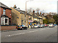
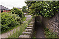
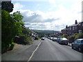
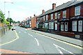
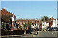
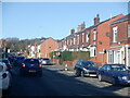
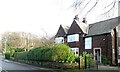
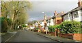
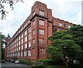
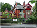
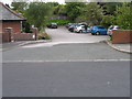
48 photos from this area
Area Information
Key information about the BL1 8SF including its size, population, and administrative classification.
- Area Type
- Postcode
- Area Size
- 9321 m²
- Population
- 1521
- Population Density
- 3439 people/km²
House Prices in BL1 8SF
24
Properties
£142,044
Average Sold Price
£55,250
Lowest Price
£275,000
Highest Price
Showing 24 properties
| Address | Type | Beds | Baths | Last Sale Price | Last Sale Date | |
|---|---|---|---|---|---|---|
| 7 Whitegate Drive, Bolton, BL1 8SF | Semi-detached | 3 | 1 | £227,000 | Sep 2025 | |
| 15 Whitegate Drive, Bolton, BL1 8SF | Semi-detached | 4 | 1 | £275,000 | Feb 2024 | |
| 19 Whitegate Drive, Bolton, BL1 8SF | Bungalow | - | - | £170,000 | Aug 2021 | |
| 9 Whitegate Drive, Bolton, BL1 8SF | house | - | - | £170,000 | Jul 2019 | |
| 47 Whitegate Drive, Bolton, BL1 8SF | Bungalow | 2 | 1 | £137,000 | Mar 2018 | |
| 35 Whitegate Drive, Bolton, BL1 8SF | Semi-detached | 2 | - | £119,000 | Oct 2014 | |
| 41 Whitegate Drive, Bolton, BL1 8SF | Bungalow | - | - | £132,000 | Dec 2013 | |
| 43 Whitegate Drive, Bolton, BL1 8SF | Bungalow | - | - | £122,495 | Jul 2013 | |
| 33 Whitegate Drive, Bolton, BL1 8SF | Bungalow | - | - | £130,000 | Feb 2013 | |
| 45 Whitegate Drive, Bolton, BL1 8SF | Bungalow | 2 | - | £117,500 | Aug 2012 |
Page 1 of 3
Energy Efficiency in BL1 8SF
Amenities
Schools
| Rank | School | Type | Entry gender | Ages |
|---|
Explore more schools in this area
Go to Schools tabDemographics
Household Size
Two person
most common
Accommodation Type
Houses
most common
Tenure
89
majority
Ethnic Group
White
most common
Religion
N/A
most common
Household Composition
N/A
most common
Age
47
median
Adults (30-64 years)
most common
Household Deprivation
N/A
with no deprivation
NS-SEC
28
in Lower managerial occupations
Explore more demographic insights in this area
Go to Demographics tabPlanning
Planning Constraints
- Flood RiskPremium
- Ramsar Wetland SitesPremium
- Area of Outstanding Natural BeautyPremium
- Protected Nature ReservePremium
- Protected WoodlandPremium