Area Overview for BL1 8RR
Photos of BL1 8RR
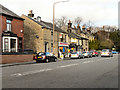
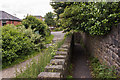
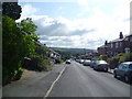
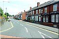
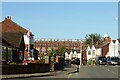
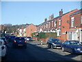
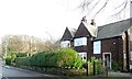
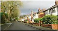
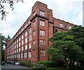
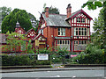
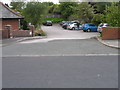
48 photos from this area
Area Information
Key information about the BL1 8RR including its size, population, and administrative classification.
- Area Type
- Postcode
- Area Size
- 1.1 hectares
- Population
- 1521
- Population Density
- 3439 people/km²
House Prices in BL1 8RR
32
Properties
£155,591
Average Sold Price
£48,500
Lowest Price
£245,000
Highest Price
Showing 32 properties
| Address | Type | Beds | Baths | Last Sale Price | Last Sale Date | |
|---|---|---|---|---|---|---|
| 156 Ashworth Lane, Bolton, BL1 8RR | Semi-detached | 3 | 1 | £240,000 | Mar 2024 | |
| 93 Ashworth Lane, Bolton, BL1 8RR | Semi-detached | 3 | 1 | £245,000 | Mar 2024 | |
| 164 Ashworth Lane, Bolton, BL1 8RR | Semi-detached | - | - | £133,332 | May 2023 | |
| 128 Ashworth Lane, Bolton, BL1 8RR | Semi-detached | 3 | 1 | £185,000 | Jan 2023 | |
| 140 Ashworth Lane, Bolton, BL1 8RR | Retail | 3 | - | £200,000 | Jul 2022 | |
| 138 Ashworth Lane, Bolton, BL1 8RR | Semi-detached | 3 | 1 | £200,000 | Nov 2021 | |
| 134 Ashworth Lane, Bolton, BL1 8RR | house | - | - | £180,000 | Oct 2020 | |
| 122 Ashworth Lane, Bolton, BL1 8RR | Semi-detached | 3 | - | £152,000 | Jun 2016 | |
| 103 Ashworth Lane, Bolton, BL1 8RR | Bungalow | 3 | 1 | £178,500 | Jul 2015 | |
| 95 Ashworth Lane, Bolton, BL1 8RR | house | 3 | 1 | £123,000 | Oct 2013 |
Page 1 of 4
Energy Efficiency in BL1 8RR
Amenities
Schools
| Rank | School | Type | Entry gender | Ages |
|---|
Explore more schools in this area
Go to Schools tabDemographics
Household Size
Two person
most common
Accommodation Type
Houses
most common
Tenure
89
majority
Ethnic Group
White
most common
Religion
N/A
most common
Household Composition
N/A
most common
Age
47
median
Adults (30-64 years)
most common
Household Deprivation
N/A
with no deprivation
NS-SEC
28
in Lower managerial occupations
Explore more demographic insights in this area
Go to Demographics tabPlanning
Planning Constraints
- Flood RiskPremium
- Ramsar Wetland SitesPremium
- Area of Outstanding Natural BeautyPremium
- Protected Nature ReservePremium
- Protected WoodlandPremium