Area Overview for BL1 7BL
Photos of BL1 7BL
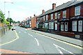
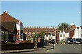
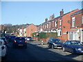
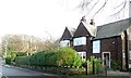
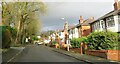
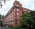
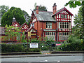
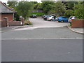
48 photos from this area
Area Information
Key information about the BL1 7BL including its size, population, and administrative classification.
- Area Type
- Postcode
- Area Size
- 8216 m²
- Population
- 1846
- Population Density
- 5671 people/km²
House Prices in BL1 7BL
16
Properties
£169,682
Average Sold Price
£82,400
Lowest Price
£259,950
Highest Price
Showing 16 properties
| Address | Type | Beds | Baths | Last Sale Price | Last Sale Date | |
|---|---|---|---|---|---|---|
| 1 Elsham Close, Bolton, BL1 7BL | Detached | 2 | 2 | £192,000 | Mar 2024 | |
| 16 Elsham Close, Bolton, BL1 7BL | Detached | 3 | 2 | £193,000 | Oct 2019 | |
| 5 Elsham Close, Bolton, BL1 7BL | Detached | 4 | 2 | £259,950 | Oct 2018 | |
| 8 Elsham Close, Bolton, BL1 7BL | Detached | 3 | 2 | £185,000 | Apr 2018 | |
| 3 Elsham Close, Bolton, BL1 7BL | Detached | 3 | 1 | £187,000 | May 2015 | |
| 10 Elsham Close, Bolton, BL1 7BL | Detached | 3 | 2 | £150,000 | Sep 2012 | |
| 2 Elsham Close, Bolton, BL1 7BL | house | 4 | - | £215,000 | Jul 2012 | |
| 4 Elsham Close, Bolton, BL1 7BL | Detached | 5 | 1 | £192,000 | Jan 2011 | |
| 22 Elsham Close, Bolton, BL1 7BL | Detached | 4 | 2 | £200,000 | Aug 2010 | |
| 9 Elsham Close, Bolton, BL1 7BL | house | - | - | £217,000 | Nov 2006 |
Page 1 of 2
Energy Efficiency in BL1 7BL
Amenities
Schools
| Rank | School | Type | Entry gender | Ages |
|---|
Explore more schools in this area
Go to Schools tabDemographics
Household Size
Family (3-5 people)
most common
Accommodation Type
Houses
most common
Tenure
41
majority
Ethnic Group
White
most common
Religion
N/A
most common
Household Composition
N/A
most common
Age
47
median
Adults (30-64 years)
most common
Household Deprivation
N/A
with no deprivation
NS-SEC
26
in Lower managerial occupations
Explore more demographic insights in this area
Go to Demographics tabPlanning
Planning Constraints
- Flood RiskPremium
- Ramsar Wetland SitesPremium
- Area of Outstanding Natural BeautyPremium
- Protected Nature ReservePremium
- Protected WoodlandPremium