Area Overview for BL1 6PN
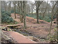
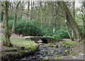
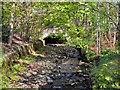
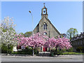
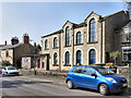
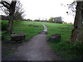
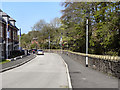
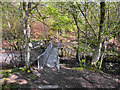
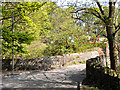
Photos of BL1 6PN

Area Information
Living in BL1 6PN means residing within a compact residential cluster that covers just 1.4 hectares, home to a population of 1,765. This postcode sits at the heart of Astley Bridge, a village located approximately 3 miles north of Bolton town centre within the Borough of Bolton unitary authority in Greater Manchester. The area corresponds to the modern Astley Bridge Ward and lies partly within the historical township of Sharples, sitting near the Bolton and Blackburn railway line. Prospective residents find themselves in a space that balances historical depth with modern convenience, given its proximity to established transport routes dating back to the 19th century. The village was first described in 1870-72, featuring a church built in 1848 and historical connections to the manor of Sharples. Today, the community reflects these roots while accommodating a steady stream of adults and families seeking a quieter rural fringe lifestyle close to urban employment hubs. You will find a neighbourhood where the density feels high relative to the area size, creating a tight-knit environment rather than a sprawling suburban sprawl.
- Area Type
- Postcode
- Area Size
- 1.4 hectares
- Population
- 1765
- Population Density
- 5683 people/km²
Homes in BL1 6PN are primarily houses, which aligns with the area's classification as a village within the Borough of Bolton. The high level of home ownership at 60 per cent confirms that the market here is dominated by owner-occupiers rather than the private rental sector. This dynamic suggests stability within the local housing stock, as owners tend to maintain their properties longer and are less likely to move frequently compared to tenants. For buyers looking at this small 1.4-hectare cluster, the predominance of house accommodation means you will find standard residential properties suited to families and retired occupants. The sizeable owner-occupancy rate often correlates with lower turnover in the immediate vicinity, making neighbourhood relationships more established. While specific price data is not included in the current assessment, the nature of the housing stock indicates a traditional market typical of Greater Manchester villages near industrial towns. You can expect to be competing mainly with other homeowners or those funded through help-to-buy schemes, rather than dealing with a high volume of furnished rentals.
House Prices in BL1 6PN
Showing 5 properties
| Address | Type | Beds | Baths | Last Sale Price | Last Sale Date | |
|---|---|---|---|---|---|---|
| 6 Oldhams Lane, Bolton, BL1 6PN | Terraced | 3 | 3 | £360,000 | Apr 2023 | |
| 2 Oldhams Lane, Bolton, BL1 6PN | Terraced | - | - | £129,995 | Aug 2002 | |
| 8 Oldhams Lane, Bolton, BL1 6PN | Detached | - | - | £249,950 | Aug 2001 | |
| 4 Oldhams Lane, Bolton, BL1 6PN | Terraced | 4 | 2 | £96,000 | May 1999 | |
| St Josephs, 10 Oldhams Lane, Bolton, BL1 6PN | Detached | - | - | - | - |
Energy Efficiency in BL1 6PN
Residents of BL1 6PN enjoy practical access to a range of amenities within a short driving distance, primarily located in Bolton and the surrounding borough. For shopping needs, the area is near five retail venues, including Asda Bolton, Lidl Bolton, and Spar. These specific chains provide immediate access to daily groceries, household essentials, and general goods without the need to travel to the city centre. Transport connectivity is extensive, with five railway stations noted as nearby options. Hall i' th' Wood Railway Station, Bromley Cross Railway Station, and Bolton Railway Station are all within practical reach, offering direct links to Manchester, Liverpool, and beyond. Additionally, five metro locations serve the area, including Radcliffe, Bury Bolton Street, and Bury Interchange. This network provides flexibility for commuters who might prefer light rail for certain journeys. The combination of large supermarkets and major railway hubs creates a lifestyle where daily necessities and long-distance travel are both easily managed.
Amenities
Schools
Families considering BL1 6PN have access to two primary schools with good Ofsted ratings listed as immediate options. The first is Holy Infant and St Anthony RC Primary School, which is rated good and caters to Roman Catholic families or those seeking a faith-based education. The second option is Thornleigh Salesian College, also a primary school rated good by Ofsted. This means that children living in this postcode have access to locally-rated educational institutions without needing to travel far to the major towns. The presence of two schools with good ratings suggests a baseline quality of education that meets government standards. Both institutions serve the immediate neighbourhood, reducing travel time for drop-offs and pick-ups for residents in this 1.4-hectare area. For parents who require both faith-based and non-denominational primary options close to home, these two schools provide a practical choice within the Astley Bridge ward.
| Rank | School | Type | Entry gender | Ages |
|---|
Explore more schools in this area
Go to Schools tabDemographics
The community in BL1 6PN is defined by a mature population, with a median age of 47 years. Adults between the ages of 30 and 64 represent the most common age range, suggesting a family-oriented demographic or a population consisting of empty nesters and established professionals. This age profile influences the character of the local shops and services, often catering to older children, teenagers, and young adults alike. Home ownership stands at 60 per cent, indicating that a clear majority of residents are likely to be owner-occupiers rather than tenants. This statistic points towards a stable community where long-term residents hold the keys to their homes. The predominant ethnic group in the area is White, reflecting the broader demographic trends of the North West of England. Most accommodation types are houses, which aligns with the village setting and the historical development of Astley Bridge. You should expect a neighbourhood composed largely of residential dwellings rather than high-rise blocks or student accommodation. These figures paint a picture of a settled, locally-rooted community where people tend to stay put.
Household Size
Accommodation Type
Tenure
Ethnic Group
Religion
Household Composition
Age
Household Deprivation
NS-SEC
Explore more demographic insights in this area
Go to Demographics tabPlanning
Planning Constraints
- Flood RiskPremium
- Ramsar Wetland SitesPremium
- Area of Outstanding Natural BeautyPremium
- Protected Nature ReservePremium
- Protected WoodlandPremium