Area Overview for BL1 6NR
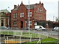
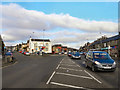
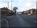
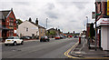
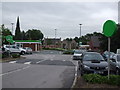
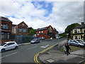
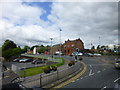
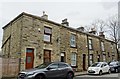
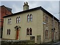
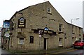
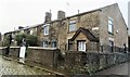
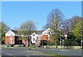
Photos of BL1 6NR
Area Information
BL1 6NR is a small residential postcode area in England, covering just 1.0 hectare with a population of 1,658 people. Its high population density of 161,697 people per km² reflects a compact, closely knit community. Situated in the historic village of Astley Bridge, part of Bolton’s Borough, it lies about 3 miles north of Bolton town centre. The area has roots in the 19th century, with a church built in 1848 and historical ties to the Sharples Hall estate. Today, it offers a mix of modern living and historical character, with proximity to railway lines that once connected Bolton and Blackburn. Residents benefit from nearby amenities, including retail stores and public transport hubs, while the area’s small size fosters a sense of familiarity. For those seeking a quiet, established neighbourhood with easy access to urban services, BL1 6NR presents a distinctive blend of residential density and historical context.
- Area Type
- Postcode
- Area Size
- 1.0 hectares
- Population
- 1658
- Population Density
- 3217 people/km²
The property market in BL1 6NR is characterised by a 55% home ownership rate, with houses forming the primary accommodation type. This suggests a mix of owner-occupied properties and rental homes, though the small area size (1.0 hectare) means the housing stock is limited. The predominance of houses, rather than flats or apartments, indicates a focus on family-friendly or semi-detached properties. Given the area’s compact nature, buyers may need to consider nearby postcode areas for more options. The high population density implies that properties here are likely to be older, with potential for renovation or modernisation. For those seeking a residential area with a balance of privacy and proximity to urban amenities, BL1 6NR’s housing stock offers a blend of traditional and practical living spaces. However, the limited size of the area means competition for properties could be fierce, particularly for first-time buyers.
House Prices in BL1 6NR
No properties found in this postcode.
Energy Efficiency in BL1 6NR
Living in BL1 6NR offers a practical lifestyle with nearby amenities. Retail options include Asda Bolton, Farmfoods Halliwell, and Lidl Bolton, providing access to groceries and daily essentials. Public transport is robust, with five railway stations—Hall i’ th’ Wood, Bromley Cross, and Bolton among them—offering connections to Bolton and surrounding areas. Three metro stops, including Bury Interchange, link to broader regional networks. While the area itself is small, its proximity to Bolton ensures residents can access larger leisure and cultural facilities. The presence of historical sites like the 1848 church and Sharples Hall adds local character. For daily life, the combination of retail, transport, and historical context creates a balance between convenience and community identity, making it suitable for those prioritising accessibility over expansive green spaces.
Amenities
Schools
| Rank | School | Type | Entry gender | Ages |
|---|
Explore more schools in this area
Go to Schools tabDemographics
The population of BL1 6NR has a median age of 47, with the majority of residents aged between 30 and 64 years. This suggests a community dominated by working-age adults and families. Home ownership stands at 55%, with houses being the predominant type of accommodation. The predominant ethnic group is White, reflecting the area’s demographic profile. The high population density—over 160,000 people per km²—indicates a compact, possibly multi-generational living environment. While no specific deprivation data is provided, the age range and home ownership rate suggest a stable, mature population. The absence of significant diversity data means the community’s social composition remains largely homogenous. For buyers, this profile indicates a neighbourhood likely to appeal to professionals and families seeking established housing with a focus on proximity to services rather than large-scale development.
Household Size
Accommodation Type
Tenure
Ethnic Group
Religion
Household Composition
Age
Household Deprivation
NS-SEC
Explore more demographic insights in this area
Go to Demographics tabPlanning
Planning Constraints
- Flood RiskPremium
- Ramsar Wetland SitesPremium
- Area of Outstanding Natural BeautyPremium
- Protected Nature ReservePremium
- Protected WoodlandPremium