Area Overview for BL0 9EG
Photos of BL0 9EG
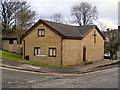
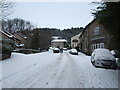
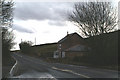
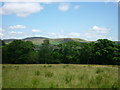
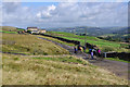
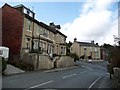
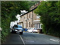
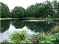
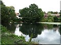
65 photos from this area
Area Information
Key information about the BL0 9EG including its size, population, and administrative classification.
- Area Type
- Postcode
- Area Size
- 6623 m²
- Population
- Not available
- Population Density
- Not available
House Prices in BL0 9EG
9
Properties
£219,438
Average Sold Price
£65,000
Lowest Price
£670,000
Highest Price
Showing 9 properties
| Address | Type | Beds | Baths | Last Sale Price | Last Sale Date | |
|---|---|---|---|---|---|---|
| 85 Carr Street, Ramsbottom, BL0 9EG | Detached | 4 | 3 | £670,000 | Oct 2023 | |
| 92 Carr Street, Ramsbottom, BL0 9EG | Terraced | 3 | 1 | £271,000 | Oct 2023 | |
| 84 Carr Street, Ramsbottom, BL0 9EG | Terraced | 3 | 1 | £161,000 | Jul 2020 | |
| 90 Carr Street, Ramsbottom, BL0 9EG | Terraced | 3 | 1 | £174,000 | Aug 2019 | |
| 86 Carr Street, Ramsbottom, BL0 9EG | Terraced | 2 | 1 | £170,000 | May 2017 | |
| 88 Carr Street, Ramsbottom, BL0 9EG | Terraced | - | - | £119,500 | Apr 2005 | |
| 82 Carr Street, Ramsbottom, BL0 9EG | Terraced | 3 | 1 | £125,000 | May 2002 | |
| 94 Carr Street, Ramsbottom, BL0 9EG | Terraced | - | - | £65,000 | Dec 1998 | |
| 96 Carr Street, Ramsbottom, BL0 9EG | restaurant_cafe | - | - | - | - |
Energy Efficiency in BL0 9EG
Amenities
Schools
| Rank | School | Type | Entry gender | Ages |
|---|
Explore more schools in this area
Go to Schools tabDemographics
Household Size
Two person
most common
Accommodation Type
Houses
most common
Tenure
77
majority
Ethnic Group
White
most common
Religion
N/A
most common
Household Composition
N/A
most common
Age
47
median
Adults (30-64 years)
most common
Household Deprivation
N/A
with no deprivation
NS-SEC
45
in Lower managerial occupations
Explore more demographic insights in this area
Go to Demographics tabPlanning
Planning Constraints
- Flood RiskPremium
- Ramsar Wetland SitesPremium
- Area of Outstanding Natural BeautyPremium
- Protected Nature ReservePremium
- Protected WoodlandPremium