Area Overview for BB5 4FF
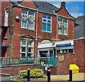
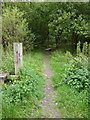
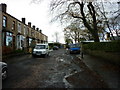
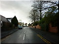
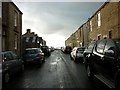
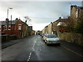
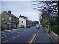
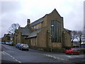
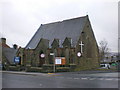
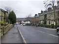
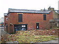
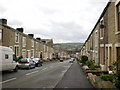
Photos of BB5 4FF
Area Information
Living in BB5 4FF means being part of a tightly knit residential cluster in the Hyndburn Borough Council area of Lancashire. This postcode covers 2.2 hectares and is home to 1,432 people, creating a densely populated yet compact community. The area’s proximity to Queen’s Road and Whalley Road suggests a mix of established housing and local amenities. Daily life here is shaped by its small-scale character, with residents likely relying on nearby schools, rail networks, and retail hubs. The presence of three schools, including a Church of England primary and an academy, indicates a focus on education. While the area lacks expansive green spaces, its connectivity to rail services like Accrington Railway Station and access to nearby towns such as Rawtenstall via metro links provide practical mobility. BB5 4FF is a place where proximity to essential services and a stable population base define the rhythm of everyday living, though its small size means community dynamics are closely interwoven.
- Area Type
- Postcode
- Area Size
- 2.2 hectares
- Population
- 1432
- Population Density
- 4640 people/km²
The property market in BB5 4FF is characterised by a strong presence of owner-occupied homes, with 56% of residents owning their properties. The accommodation type is predominantly houses, which suggests a focus on family homes and stable, long-term living arrangements. This contrasts with areas where rental properties dominate, indicating that BB5 4FF may appeal to buyers seeking a settled lifestyle rather than short-term investment. The small area size and high population density imply limited scope for new developments, which could make the existing housing stock particularly valuable. For buyers, this means competition for available properties may be keen, especially given the proximity to schools and transport links. The predominance of houses also suggests that the area is less suited to those prioritising flats or shared housing, though the compact nature of the postcode may limit options for expansion.
House Prices in BB5 4FF
Showing 1 properties
| Address | Type | Beds | Baths | Last Sale Price | Last Sale Date | |
|---|---|---|---|---|---|---|
| Accrington Moorhead High School, Cromwell Avenue, Accrington, BB5 4FF | commercial | - | - | - | - |
Energy Efficiency in BB5 4FF
The lifestyle in BB5 4FF is shaped by its proximity to essential amenities. Retail options include Asda Accrington, Aldi Milnshaw, and Farmfoods Milnshaw, offering a range of shopping needs within walking or short driving distance. The rail network, with stations such as Accrington Railway Station and Church & Oswaldtwistle, provides easy access to commuting routes and regional hubs. A metro link to Rawtenstall adds flexibility for travel. While specific parks or leisure facilities are not detailed in the data, the compact nature of the area suggests that local green spaces or community centres may be nearby. The presence of multiple schools and transport links indicates a focus on practicality, ensuring residents can balance daily routines with access to services. The area’s small size means amenities are concentrated, fostering a sense of convenience for those prioritising proximity over expansive facilities.
Amenities
Schools
Residents of BB5 4FF have access to three schools within practical reach. Accrington St Mary Magdalen’s Church of England Primary School, rated ‘good’ by Ofsted, provides a primary education option with a religious affiliation. Accrington Moorhead Sports College, also a primary school, offers a different educational approach, though its Ofsted rating is not specified. For secondary education, Accrington Academy is an academy school with a ‘satisfactory’ Ofsted rating. This mix of school types allows families to choose between faith-based and state-run institutions, though the ratings suggest variability in quality. The presence of both primary and secondary options within the area reduces the need for long commutes, which is a practical advantage for parents. However, the academy’s ‘satisfactory’ rating indicates there may be room for improvement in certain aspects of its performance.
| Rank | School | Type | Entry gender | Ages |
|---|
Explore more schools in this area
Go to Schools tabDemographics
The community in BB5 4FF is predominantly composed of adults aged 30–64, with a median age of 47. This suggests a mature, established population, likely with long-term ties to the area. Home ownership rates stand at 56%, indicating a balance between owner-occupied properties and rental stock. The accommodation type is primarily houses, which aligns with the area’s residential character. The predominant ethnic group is White, reflecting the broader demographic trends in the region. With a population density of 65,593 people per square kilometre, the area is highly compact, which may influence social interactions and local infrastructure demands. The absence of specific deprivation data means the quality of life is inferred from the availability of amenities and services, though the medium crime risk score of 43 suggests residents should remain mindful of standard security measures.
Household Size
Accommodation Type
Tenure
Ethnic Group
Religion
Household Composition
Age
Household Deprivation
NS-SEC
Explore more demographic insights in this area
Go to Demographics tabPlanning
Planning Constraints
- Flood RiskPremium
- Ramsar Wetland SitesPremium
- Area of Outstanding Natural BeautyPremium
- Protected Nature ReservePremium
- Protected WoodlandPremium