Area Overview for BB5 5AF
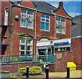
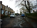
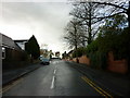
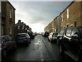
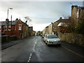
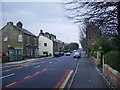
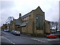
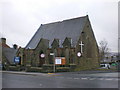
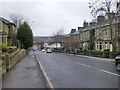
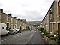
Photos of BB5 5AF
Area Information
Living in BB5 5AF means being part of a small, tightly knit residential cluster in Lancashire’s Hyndburn Borough Council area. With a population of 1,432, this postcode is a quiet, low-density community where daily life is shaped by proximity to local amenities and a mix of family-oriented and mature residents. The area sits near Accrington, a town with historical roots and modern infrastructure, offering a blend of traditional charm and practical convenience. Residents benefit from nearby schools, rail links, and retail hubs, while the landscape remains relatively unspoiled by urban sprawl. The median age of 47 suggests a community rooted in stability, with many residents likely to have lived in the area for years. BB5 5AF’s compact size means that essentials like shops, transport, and green spaces are within easy reach, making it appealing for those seeking a balance between tranquillity and accessibility. However, the area’s small footprint also means that housing options are limited, and buyers should consider the broader Hyndburn region for more choices. For those prioritising safety and a manageable pace of life, BB5 5AF offers a distinct alternative to larger towns.
- Area Type
- Postcode
- Area Size
- Not available
- Population
- 1432
- Population Density
- 4640 people/km²
The property market in BB5 5AF is characterised by a 56% home ownership rate, with houses forming the predominant accommodation type. This suggests a market skewed towards owner-occupied properties rather than rental units, though the small population of 1,432 means the housing stock is limited. The focus on houses, as opposed to flats or apartments, indicates a preference for single-family homes, which may appeal to families or individuals seeking more space. However, the area’s compact size means that buyers may need to look beyond BB5 5AF itself to find additional options, particularly in nearby parts of Hyndburn. The limited availability of properties could drive competition among buyers, especially for homes near key amenities like schools and transport links. For those considering the area, the mix of houses and the proximity to retail and rail networks may make it attractive, though the small footprint of the postcode means that the immediate surroundings, rather than BB5 5AF itself, will determine the full range of property choices.
House Prices in BB5 5AF
No properties found in this postcode.
Energy Efficiency in BB5 5AF
The lifestyle in BB5 5AF is shaped by its proximity to essential amenities, with five retail outlets within easy reach, including Asda Accrington, Aldi Milnshaw, and Farmfoods Milnshaw. These shops provide convenience for grocery shopping and daily needs, reducing the need for long commutes. The area’s rail network, featuring stations like Accrington and Huncoat, connects residents to nearby towns, while the Rawtenstall metro link offers broader regional access. Though specific parks or leisure facilities are not detailed in the data, the presence of multiple schools and community-focused retail options suggests a lifestyle centred on practicality and local engagement. The small size of the postcode means that amenities are tightly clustered, allowing residents to access shops, transport, and services without extensive travel. This compactness fosters a sense of convenience, though those seeking expansive recreational spaces may need to venture beyond BB5 5AF itself.
Amenities
Schools
Residents of BB5 5AF have access to a range of educational institutions, including primary and secondary schools. The nearby Accrington St Mary Magdalen’s Church of England Primary School is rated ‘good’ by Ofsted, offering a solid foundation for younger children. The Accrington Moorhead Sports College, also a primary school, provides additional options for families. For secondary education, the Accrington Academy is an academy with a ‘satisfactory’ Ofsted rating, though it may require commuting to reach. The mix of primary schools and an academy suggests a tiered system that could accommodate different educational preferences, though the absence of a secondary school within the immediate area means families may need to consider travel times. The presence of multiple schools within practical reach enhances the area’s appeal for families, though the ratings highlight that while some institutions perform well, others may require closer scrutiny.
| Rank | School | Type | Entry gender | Ages |
|---|
Explore more schools in this area
Go to Schools tabDemographics
The community in BB5 5AF is predominantly composed of adults aged 30–64, with a median age of 47. This suggests a mature population, likely with established careers and family ties to the area. Home ownership stands at 56%, indicating that nearly half of residents live in properties they own, while the remaining 44% are likely to rent. The accommodation type is primarily houses, reflecting a preference for single-family homes over flats or apartments. The predominant ethnic group is White, though no specific data on diversity or deprivation is provided. This demographic profile points to a stable, middle-aged population with a focus on long-term residency. The age range implies a mix of working professionals and retirees, though the absence of data on younger families or students means the full spectrum of household types remains unclear. The relatively high home ownership rate may suggest a community with financial security, though the lack of detailed socioeconomic data limits deeper analysis of quality of life factors.
Household Size
Accommodation Type
Tenure
Ethnic Group
Religion
Household Composition
Age
Household Deprivation
NS-SEC
Explore more demographic insights in this area
Go to Demographics tabPlanning
Planning Constraints
- Flood RiskPremium
- Ramsar Wetland SitesPremium
- Area of Outstanding Natural BeautyPremium
- Protected Nature ReservePremium
- Protected WoodlandPremium