Area Overview for BB4 7JG
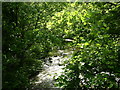
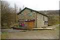
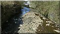
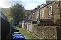
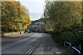
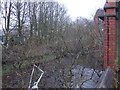
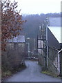
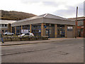
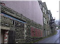
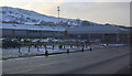
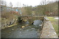
Photos of BB4 7JG
Area Information
Residents of BB4 7JG live in a specific residential cluster within the larger market town of Waterfoot. This postcode represents a small but distinct part of the Borough of Rossendale, covering an area of only 4800 m² yet housing a population of 1411 people. The density here is unusually high at 293,932 people per square kilometre, indicating a compact, village-like living environment where neighbours are likely close by. Waterfoot itself sits at the confluence of Whitewell Brook and the River Irwell, positioned between Rawtenstall and Bacup. The character of the area reflects its historic role as an industrial centre for felt-making and textiles, with a heritage preserved in landmarks like the decorative iron and glass Victorian arcade. Living in BB4 7JG means residing in a tight-knit community where the past is visibly embedded in the built environment. You are stepping into a zone defined by its small footprint and significant population concentration, offering a settled, non-urban lifestyle close to the major transport routes of the B6238 and A681 roads.
- Area Type
- Postcode
- Area Size
- 4800 m²
- Population
- 1411
- Population Density
- 2719 people/km²
The property market in BB4 7JG is characterised by a solid majority of owner-occupied homes. With 51% home ownership, the area functions as a place people buy into for the long term rather than a location dominated by short-term tenancies. You will find mostly houses as the primary accommodation type, reflecting the area's development as a residential cluster outside the immediate flood zones of the river, despite the overall safety rating for the zone. This high ownership rate implies that price sensitivity may be higher among buyers looking for entry-level properties, as many potential vendors are already settled homeowners. The small physical size of the postcode might limit the variety of property sizes available, meaning choices could be narrow for those seeking a detached large home. Buying a home in BB4 7JG offers the stability of a traditional neighbourhood where residents have a vested interest in maintaining property values. The market here is not a high-turnover rental hub but a stable enclave where buyers compete for a finite number of residential units within the 4800 m² boundary.
House Prices in BB4 7JG
Showing 10 properties
| Address | Type | Beds | Baths | Last Sale Price | Last Sale Date | |
|---|---|---|---|---|---|---|
| 12 Holt Mill Road, Waterfoot, Rossendale, BB4 7JG | house | - | - | £105,000 | Nov 2023 | |
| 14 Holt Mill Road, Waterfoot, Rossendale, BB4 7JG | Terraced | 2 | 1 | £70,000 | Aug 2019 | |
| 16 Holt Mill Road, Waterfoot, Rossendale, BB4 7JG | Terraced | 2 | 1 | £58,000 | Dec 2015 | |
| 10 Holt Mill Road, Waterfoot, Rossendale, BB4 7JG | house | 2 | 1 | £82,500 | Apr 2012 | |
| 18 Holt Mill Road, Waterfoot, Rossendale, BB4 7JG | house | 2 | - | £85,000 | Aug 2011 | |
| 8 Holt Mill Road, Waterfoot, Rossendale, BB4 7JG | Terraced | 2 | 1 | £99,950 | May 2006 | |
| Newground, St Michaels Outdoor Training, Holt Mill Road, Waterfoot, Rossendale, BB4 7JG | Leisure | - | - | - | - | |
| 6 Holt Mill Road, Waterfoot, Rossendale, BB4 7JG | Terraced | - | - | - | - | |
| 4 Holt Mill Road, Waterfoot, Rossendale, BB4 7JG | Terraced | - | - | - | - | |
| 2 Holt Mill Road, Waterfoot, Rossendale, BB4 7JG | Terraced | - | - | - | - |
Energy Efficiency in BB4 7JG
Daily life in BB4 7JG is supported by practical amenities located within easy reach of the local cluster. Residents have access to five key retail venues, including the Co-op Waterfoot, Lidl Rawtenstall, and Tesco Rawtenstall. These shops provide essential groceries and daily necessities, meaning you do not need to travel far for your shopping requirements. For travel to wider destinations, the area is served by two transport hubs: Rawtenstall and Ramsbottom. Additionally, Accrington Railway Station is available as a rail option for longer journeys. The nearby town of Waterfoot itself features a Town Centre Conservation Area, preserving the historic streets including the Victorian arcade built by Sir Henry Whittaker Trickett. You can walk past the eight hidden shop spaces of Trickett's Arcade and enjoy the distinct iron and glass architecture. This mix of modern retail chains and historic conservation areas creates a functional yet character-rich lifestyle where everyday errands are combined with local heritage.
Amenities
Schools
Families living in BB4 7JG have access to specific educational institutions located within the wider Waterfoot catchment. The nearest primary school is Rawtenstall Newchurch Church of England Primary School, which holds a Good Ofsted rating. This indicates a standard of education that meets the expected benchmarks for primary learning and student well-being. While the data does not list secondary options or state schools explicitly within this specific cluster, the presence of a rated primary school is a concrete factor for families choosing BB4 7JG for its convenience. The School Type here is primary, serving children from early education up to the age of eleven. For children of school age, this means a short commute to a local facility with a proven track record of quality. The Good rating provides a factual basis for confidence in the education available near this postcode, ensuring that young residents are taught in environments that undergo regular inspection and meet government standards.
| Rank | School | Type | Entry gender | Ages |
|---|
Explore more schools in this area
Go to Schools tabDemographics
The community in BB4 7JG is defined by a mature population with a median age of 47 years. The most common age group consists of adults between 30 and 64 years old, suggesting a demographic that includes families with school-age children and empty nesters. Housing is predominantly taken by houses rather than flats or other accommodation types, fitting the traditional residential structure of Waterfoot. Home ownership is strong in this cluster, with 51% of residents owning their property outright or with a mortgage. The predominant ethnic group is White, which aligns with the wider rural and industrial history of the Lancashire region. This demographic profile points to a stable, established community rather than a transient rental market. With over half the homes owned by residents, the streetscape likely features long-term families who have settled in the area. This ownership rate often correlates with lower turnover and community cohesion, though the high density means the local infrastructure must support a concentrated number of households in a very small space.
Household Size
Accommodation Type
Tenure
Ethnic Group
Religion
Household Composition
Age
Household Deprivation
NS-SEC
Explore more demographic insights in this area
Go to Demographics tabPlanning
Planning Constraints
- Flood RiskPremium
- Ramsar Wetland SitesPremium
- Area of Outstanding Natural BeautyPremium
- Protected Nature ReservePremium
- Protected WoodlandPremium