Area Overview for BB12 8RP
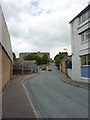
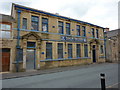
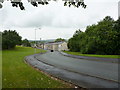
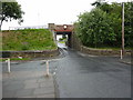
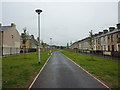
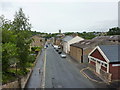
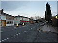
Photos of BB12 8RP

Area Information
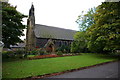
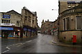
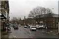
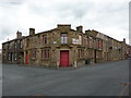
BB12 8RP lies within Padiham, a historic market town in Lancashire, England, known for its conservation area status and Anglo-Saxon origins. This small postcode area, covering 5,252 square metres, is densely populated, with 1,536 residents living at a density of 292,486 people per square kilometre. The town’s character is shaped by its past as a hub for cotton mills and coal mining, though its economy now relies on local services and transport links. Residents benefit from proximity to Burnley, just 3 miles east, and the nearby Leeds and Liverpool Canal. The area’s compact size means amenities are tightly clustered, with shops, rail stations, and historical sites within walking distance. Padiham’s conservation area status preserves its 19th-century architecture, including the Grade II-listed St Leonard’s Parish Church and the repurposed Victoria Mill. Daily life here balances historic charm with modern connectivity, offering a quiet alternative to larger towns while retaining access to regional infrastructure.
- Area Type
- Postcode
- Area Size
- 5252 m²
- Population
- 1536
- Population Density
- 9942 people/km²
The property market in BB12 8RP is defined by its 48% home ownership rate, indicating a mix of owner-occupied and rental properties. The area’s accommodation is predominantly houses, which is unusual for a small postcode area but reflects Padiham’s historic development as a market town with semi-detached and terraced housing. Given the high population density, housing stock is likely limited, with properties concentrated in compact clusters. This makes the area appealing to buyers seeking family homes or investors targeting the rental market. However, the small size of BB12 8RP means competition for properties is likely, particularly for homes near amenities like the railway stations or conservation areas. Buyers should consider the area’s historical character and proximity to Burnley when assessing long-term value, though the lack of major employers may influence demand.
House Prices in BB12 8RP
Showing 48 properties
| Address | Type | Beds | Baths | Last Sale Price | Last Sale Date | |
|---|---|---|---|---|---|---|
| 45 Peel Street, Padiham, BB12 8RP | Terraced | 2 | 1 | £102,950 | Sep 2025 | |
| 41 Peel Street, Padiham, BB12 8RP | Terraced | 2 | 1 | £105,000 | Jun 2025 | |
| 11 Peel Street, Padiham, BB12 8RP | Terraced | 2 | - | £62,500 | May 2025 | |
| 61 Peel Street, Padiham, BB12 8RP | Terraced | 2 | 1 | £50,000 | Apr 2025 | |
| 18 Peel Street, Padiham, BB12 8RP | house | 2 | 1 | £62,000 | Mar 2025 | |
| 43 Peel Street, Padiham, BB12 8RP | Terraced | 2 | 1 | £68,000 | Nov 2024 | |
| 53 Peel Street, Padiham, BB12 8RP | Terraced | 3 | 1 | £84,500 | Oct 2024 | |
| 22 Peel Street, Padiham, BB12 8RP | Terraced | 1 | 1 | £36,000 | Aug 2024 | |
| 21 Peel Street, Padiham, BB12 8RP | Terraced | 2 | 1 | £86,000 | Jun 2024 | |
| 12 Peel Street, Padiham, BB12 8RP | Terraced | 2 | 1 | £67,500 | May 2024 |
Energy Efficiency in BB12 8RP
Living in BB12 8RP offers access to essential amenities within practical reach. The area includes retail options like Tesco Padiham, Lidl Padiham, and Spar, providing daily shopping convenience. Nearby rail stations—Hapton, Rose Grove, and Burnley Barracks—connect residents to Burnley and surrounding areas, enhancing mobility. The town’s historic character is evident in sites like St Leonard’s Parish Church (Grade II listed) and the repurposed Victoria Mill, which now houses flats. Padiham’s conservation area status preserves its 19th-century architecture, blending heritage with modern living. The proximity to the Leeds and Liverpool Canal adds recreational value, while the compact layout ensures a walkable community. Though the area lacks large commercial centres, its small size fosters a close-knit environment where amenities are concentrated, making daily life efficient and rooted in local history.
Amenities
Schools
| Rank | School | Type | Entry gender | Ages |
|---|
Explore more schools in this area
Go to Schools tabDemographics
The population of BB12 8RP is 1,536, with a median age of 47, indicating a mature community. The most common age group is adults aged 30–64, suggesting a stable demographic with established households. Home ownership rates are 48%, meaning nearly half of properties are rented, reflecting a mix of owner-occupied and rental housing. The area’s accommodation is predominantly houses, which aligns with its small, residential character. The predominant ethnic group is White, though specific data on diversity is not detailed. The high population density—292,486 people per square kilometre—suggests compact living, potentially influencing housing costs and community interaction. This density may also mean limited space for expansion, shaping the local economy and lifestyle. The age profile and ownership statistics indicate a community focused on long-term residency, with a balance between family homes and smaller properties.
Household Size
Accommodation Type
Tenure
Ethnic Group
Religion
Household Composition
Age
Household Deprivation
NS-SEC
Explore more demographic insights in this area
Go to Demographics tabPlanning
Planning Constraints
- Flood RiskPremium
- Ramsar Wetland SitesPremium
- Area of Outstanding Natural BeautyPremium
- Protected Nature ReservePremium
- Protected WoodlandPremium