Area Overview for BB12 8DG
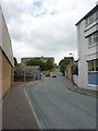
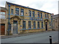
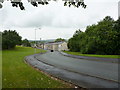
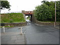
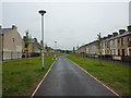
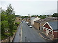
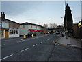
Photos of BB12 8DG

Area Information
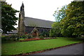
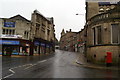
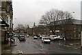
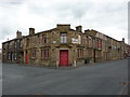
BB12 8DG lies within Padiham, a small market town in Lancashire’s Borough of Burnley. This postcode area covers 5,496 square metres, housing 1,623 residents in a densely populated cluster. The town’s history as an Anglo-Saxon settlement and 19th-century industrial hub shapes its character today, with conservation areas and historic buildings like St Leonard’s Parish Church and Victoria Mill. Daily life here is rooted in community and proximity to nature, with the River Calder nearby and Pendle Hill within reach. The area’s compact size means amenities are within walking distance, though its small scale also means limited commercial activity. Padiham’s population density—295,298 people per square kilometre—reflects its status as a tight-knit residential cluster, where residents often know their neighbours. While the town’s industrial past is evident in its architecture, modern living is supported by rail links and retail options. For buyers, BB12 8DG offers a blend of historical charm and practicality, though its size and density mean it is best suited for those prioritising community over expansive space.
- Area Type
- Postcode
- Area Size
- 5496 m²
- Population
- 1623
- Population Density
- 4332 people/km²
The property market in BB12 8DG is characterised by a 43% home ownership rate, with houses making up the majority of accommodation types. This suggests a mix of owner-occupied homes and rental properties, though the low ownership rate may indicate a reliance on private or social renting. Given the area’s small size and high density, the housing stock is likely to be compact, with limited scope for new development. The prevalence of houses rather than flats or apartments may appeal to buyers seeking traditional family homes, though the small postcode area means the market is highly localised. For buyers, this could mean competition for a limited number of properties, particularly as the area’s historical character and amenities may attract interest. However, the high population density and limited commercial activity suggest that the surrounding areas may offer more space or alternative options for those seeking expansion.
House Prices in BB12 8DG
Showing 2 properties
| Address | Type | Beds | Baths | Last Sale Price | Last Sale Date | |
|---|---|---|---|---|---|---|
| Padiham Carpet Mill Ltd, Unit 17, Riverside Mill, Lune Street, Padiham, BB12 8DG | shop | - | - | - | - | |
| Flat, Unit 2, Lune Street, Padiham, BB12 8DG | Flat | - | - | - | - |
Energy Efficiency in BB12 8DG
Living in BB12 8DG offers access to essential amenities within practical reach. Retail options include Tesco Padiham, Lidl Padiham, and Spar, providing daily shopping needs. The area’s rail network, with stations such as Hapton and Burnley Barracks, connects residents to nearby towns and services. While the postcode area itself is small, its proximity to Padiham’s historic centre and surrounding countryside offers opportunities for leisure, including walking along the River Calder or exploring Pendle Hill. The presence of conservation areas and listed buildings adds to the area’s character, though recreational facilities like parks or gyms are not detailed in the data. For residents, the lifestyle balances practicality with a sense of community, with local shops and transport links supporting daily life. However, those seeking extensive leisure amenities may need to travel further to Burnley or nearby towns.
Amenities
Schools
| Rank | School | Type | Entry gender | Ages |
|---|
Explore more schools in this area
Go to Schools tabDemographics
The population of BB12 8DG has a median age of 47, with the majority of residents aged 30–64. This suggests a community of established adults, many of whom may be retired or in their later working years. Home ownership stands at 43%, indicating a mix of owner-occupied properties and rental units. The predominant accommodation type is houses, which is notable given the area’s high population density. The demographic profile shows a predominantly White population, with no specific data on ethnic diversity beyond this. The age range and home ownership figures suggest a stable, long-term resident base, though the relatively low ownership rate may reflect economic factors or rental demand. The absence of detailed deprivation data means it is unclear how socioeconomic challenges might affect quality of life, but the age profile implies a community with established needs and priorities.
Household Size
Accommodation Type
Tenure
Ethnic Group
Religion
Household Composition
Age
Household Deprivation
NS-SEC
Explore more demographic insights in this area
Go to Demographics tabPlanning
Planning Constraints
- Flood RiskPremium
- Ramsar Wetland SitesPremium
- Area of Outstanding Natural BeautyPremium
- Protected Nature ReservePremium
- Protected WoodlandPremium