Area Overview for BB12 8AN
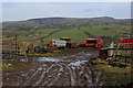
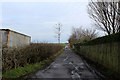
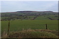
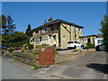
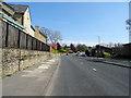
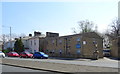
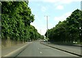
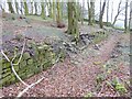
Photos of BB12 8AN
Area Information
Living in BB12 8AN means being part of a tightly knit residential cluster in the borough of Burnley, Lancashire. This postcode covers 4,759 square metres and is home to 1,345 people, giving it a population density of 484 people per square kilometre. The area has historical roots as Ightenhill, a civil parish established in 1866, with its boundaries shaped by 19th-century land divisions. Daily life here is defined by proximity to local amenities and a quiet, residential character. Residents benefit from nearby rail links, including Rose Grove, Burnley Barracks, and Burnley Central stations, which connect to major towns and cities. The area’s small size means a strong sense of community, with homes primarily occupied by owners rather than renters. For those seeking a low-maintenance lifestyle with access to essential services, BB12 8AN offers a balance of historical charm and modern convenience.
- Area Type
- Postcode
- Area Size
- 4759 m²
- Population
- 1345
- Population Density
- 484 people/km²
The property market in BB12 8AN is characterised by a high rate of home ownership, with 94% of properties occupied by their owners. This suggests a stable market with limited rental activity, making it less attractive to investors seeking short-term returns. The accommodation type is predominantly houses, which are typically larger and more suited to families or individuals preferring private spaces. Given the area’s small size, the housing stock is likely limited, meaning buyers may need to consider nearby postcodes for more options. The high home ownership rate also indicates that properties here are likely to hold value over time, though the small population and limited new developments could mean slower price growth. For buyers prioritising ownership over rental flexibility, BB12 8AN offers a quiet, established environment with a focus on traditional housing.
House Prices in BB12 8AN
Showing 7 properties
| Address | Type | Beds | Baths | Last Sale Price | Last Sale Date | |
|---|---|---|---|---|---|---|
| 13 Manor Road, Burnley, BB12 8AN | Semi-detached | 3 | 1 | £245,000 | Mar 2024 | |
| 2 Manor Road, Burnley, BB12 8AN | house | - | - | £325,000 | Sep 2021 | |
| 15 Manor Road, Burnley, BB12 8AN | Semi-detached | 3 | 1 | £207,000 | Jan 2020 | |
| 7 Manor Road, Burnley, BB12 8AN | Bungalow | 4 | 3 | £255,000 | Jul 2017 | |
| 9 Manor Road, Burnley, BB12 8AN | Semi-detached | - | - | £203,000 | May 2009 | |
| 4 Manor Road, Burnley, BB12 8AN | Detached | - | - | £170,000 | Jul 2005 | |
| 11 Manor Road, Burnley, BB12 8AN | Semi-detached | - | - | £74,950 | Jul 2001 |
Energy Efficiency in BB12 8AN
The lifestyle in BB12 8AN is shaped by its proximity to retail and rail amenities. Five retail outlets, including Spar and Farmfoods Rosehill, provide everyday shopping convenience, while nearby parks like Ightenhill Park offer green space for leisure. The park, opened in 1912, is a legacy of local heritage, offering a place for walking or relaxation. The area’s small size means amenities are within practical reach, though the lack of extensive leisure facilities may require residents to travel further for larger events or dining options. The presence of multiple rail stations also enhances access to cultural and commercial hubs beyond the immediate postcode. For those valuing a quiet, self-contained lifestyle with essential services nearby, BB12 8AN provides a blend of historical and modern conveniences.
Amenities
Schools
The nearest school to BB12 8AN is St Joseph’s Park Hill School, an independent institution. While no Ofsted rating is provided, the presence of an independent school suggests a focus on private education, which may appeal to families prioritising specific curricula or smaller class sizes. The area lacks state schools in the immediate vicinity, so families relying on public education may need to look further afield. This mix of school types reflects a community where educational preferences vary, with options ranging from state-run institutions to private alternatives. For those valuing the structure and resources of independent schools, BB12 8AN offers proximity to one, though additional research would be needed to identify nearby state schools.
| Rank | School | Type | Entry gender | Ages |
|---|
Explore more schools in this area
Go to Schools tabDemographics
The community in BB12 8AN is predominantly composed of adults aged 30 to 64, with a median age of 47. This suggests a mature population, likely with established careers and family structures. Home ownership is exceptionally high at 94%, indicating a stable, long-term resident base. The accommodation type is largely houses, reflecting a preference for single-family dwellings over flats. The predominant ethnic group is White, aligning with broader demographic trends in the region. The low population density of 484 people per square kilometre implies a spread-out, less congested living environment. While no specific deprivation data is provided, the high home ownership rate and age profile suggest a community with relatively stable economic conditions. This demographic profile may appeal to those seeking a settled, family-oriented environment with minimal turnover.
Household Size
Accommodation Type
Tenure
Ethnic Group
Religion
Household Composition
Age
Household Deprivation
NS-SEC
Explore more demographic insights in this area
Go to Demographics tabPlanning
Planning Constraints
- Flood RiskPremium
- Ramsar Wetland SitesPremium
- Area of Outstanding Natural BeautyPremium
- Protected Nature ReservePremium
- Protected WoodlandPremium