Area Overview for BB12 6TD
Photos of BB12 6TD

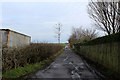
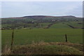
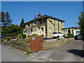
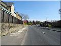
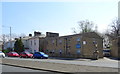
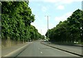
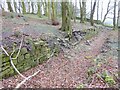
22 photos from this area
Area Information
Key information about the BB12 6TD including its size, population, and administrative classification.
- Area Type
- Postcode
- Area Size
- 1.7 hectares
- Population
- 1448
- Population Density
- 3748 people/km²
House Prices in BB12 6TD
13
Properties
£369,747
Average Sold Price
£147,500
Lowest Price
£585,000
Highest Price
Showing 13 properties
| Address | Type | Beds | Baths | Last Sale Price | Last Sale Date | |
|---|---|---|---|---|---|---|
| 464 Padiham Road, Burnley, BB12 6TD | Semi-detached | 5 | 1 | £585,000 | Jan 2025 | |
| Farrington Care Homes Ltd, Palace House Nursing Home, 460 Padiham Road, Burnley, BB12 6TD | hospital_care_home | - | - | £364,402 | Mar 2024 | |
| Misselthwaite, 5 Palace Gardens, Burnley, BB12 6TD | Detached | - | - | £386,072 | Jun 2021 | |
| 446 Padiham Road, Burnley, BB12 6TD | Detached | 4 | 2 | £325,000 | Apr 2021 | |
| 456 Padiham Road, Burnley, BB12 6TD | Detached | 4 | - | £435,000 | Sep 2020 | |
| 458 Padiham Road, Burnley, BB12 6TD | Detached | 5 | 2 | £430,000 | Oct 2019 | |
| Otterburn, 3 Palace Gardens, Burnley, BB12 6TD | Detached | 4 | 1 | £285,000 | Feb 2017 | |
| 464A Padiham Road, Burnley, BB12 6TD | Flat | - | - | £147,500 | Jun 2008 | |
| The Orchard House, 2 Palace Gardens, Burnley, BB12 6TD | Detached | 4 | 2 | - | - | |
| Former Palace House Nursing Home, 451 Padiham Road, Burnley, BB12 6TD | Retirement | - | - | - | - |
Page 1 of 2
Energy Efficiency in BB12 6TD
Amenities
Schools
| Rank | School | Type | Entry gender | Ages |
|---|
Explore more schools in this area
Go to Schools tabDemographics
Household Size
Two person
most common
Accommodation Type
Houses
most common
Tenure
70
majority
Ethnic Group
White
most common
Religion
N/A
most common
Household Composition
N/A
most common
Age
47
median
Adults (30-64 years)
most common
Household Deprivation
N/A
with no deprivation
NS-SEC
24
in Lower managerial occupations
Explore more demographic insights in this area
Go to Demographics tabPlanning
Planning Constraints
- Flood RiskPremium
- Ramsar Wetland SitesPremium
- Area of Outstanding Natural BeautyPremium
- Protected Nature ReservePremium
- Protected WoodlandPremium