Area Overview for BB12 6SX
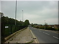
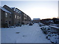
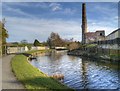
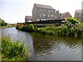
Photos of BB12 6SX
Area Information
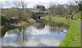
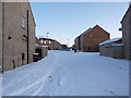
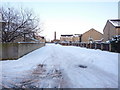
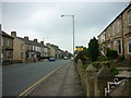
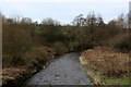
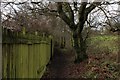
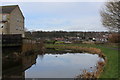
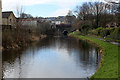
Living in BB12 6SX means being part of a tightly knit residential cluster in the Borough of Burnley, Lancashire. The area covers 3,975 m² and is home to 1,411 people, creating a dense, compact community. Historically, Gannow Ward, which includes BB12 6SX, was shaped by the Leeds and Liverpool Canal, which brought industrial activity in the late 18th century. Today, the M65 motorway divides the area from northern districts, but the legacy of the canal remains in local landmarks like Gannow Wharf. The postcode is part of a small, mature community with a median age of 47, suggesting a stable population. Residents benefit from proximity to Burnley town centre and the Gannow Business Park, which repurposes Victorian cotton mills. The area’s compact size means amenities are within walking distance, while nearby rail stations offer easy access to regional hubs. BB12 6SX is ideal for those seeking a quiet, established neighbourhood with historical roots and practical modern connectivity.
- Area Type
- Postcode
- Area Size
- 3975 m²
- Population
- 1411
- Population Density
- 6417 people/km²
The property market in BB12 6SX is dominated by owner-occupied homes, with 64% of residents living in properties they own. The accommodation type is primarily houses, which is typical of a low-density, residential postcode. This suggests a market skewed towards family homes rather than rental properties or apartments. The small area size—just 3,975 m²—means the housing stock is limited, making the local market potentially competitive for buyers. The proximity to Burnley town centre and the M65 motorway may attract those seeking a balance between suburban tranquillity and urban accessibility. However, the high population density for such a small area implies that properties are likely to be closely spaced, with limited scope for expansion. For buyers, this means the area offers a fixed number of homes, often with historical or traditional features, but little room for new developments.
House Prices in BB12 6SX
Showing 10 properties
| Address | Type | Beds | Baths | Last Sale Price | Last Sale Date | |
|---|---|---|---|---|---|---|
| 351 Padiham Road, Burnley, BB12 6SX | house | 3 | - | £154,000 | Sep 2021 | |
| 367 Padiham Road, Burnley, BB12 6SX | Semi-detached | 3 | 1 | £208,000 | Oct 2013 | |
| 359 Padiham Road, Burnley, BB12 6SX | Semi-detached | - | - | £215,000 | Oct 2007 | |
| Flat 4, 365 Padiham Road, Burnley, BB12 6SX | Flat | - | - | - | - | |
| Flat 2, 365 Padiham Road, Burnley, BB12 6SX | Flat | - | - | - | - | |
| Flat 1, 365 Padiham Road, Burnley, BB12 6SX | Flat | - | - | - | - | |
| Flat 3, 365 Padiham Road, Burnley, BB12 6SX | Flat | - | - | - | - | |
| 357 Padiham Road, Burnley, BB12 6SX | Semi-detached | - | - | - | - | |
| 353 Padiham Road, Burnley, BB12 6SX | Terraced | - | - | - | - | |
| 355 Padiham Road, Burnley, BB12 6SX | house | - | - | - | - |
Energy Efficiency in BB12 6SX
Residents of BB12 6SX have access to a range of nearby amenities, including five retail outlets such as Spar and Farmfoods Rosehill, ensuring basic shopping needs are met locally. The area’s proximity to the M65 motorway and Burnley town centre means more extensive retail and dining options are within reach. The Gannow Community Centre, acquired in 2017, serves as a social hub, hosting events and activities that foster local connections. While the area lacks large parks or leisure facilities, its compact size means amenities are within walking distance. The historical Gannow Wharf and nearby canal offer a scenic backdrop, though recreational use of the waterway is not specified. Overall, the lifestyle in BB12 6SX blends practical convenience with a sense of community, supported by nearby rail links and essential retail services.
Amenities
Schools
The nearest school to BB12 6SX is Whittlefield Primary School, which has an Ofsted rating of ‘good’. This school serves the local community and is likely a key consideration for families with young children. The absence of secondary schools in the immediate vicinity means students may need to travel to nearby areas for further education, though Burnley town centre offers broader options. The presence of a primary school with a solid rating indicates a commitment to local education, though parents should consider the need for additional transport arrangements for older children. The school’s ‘good’ rating suggests it meets national standards in teaching and facilities, but specific details on curriculum or extracurricular activities are not provided. For families prioritising proximity to schools, Whittlefield Primary is a reliable option, but further research into secondary education options would be necessary.
| Rank | School | Type | Entry gender | Ages |
|---|
Explore more schools in this area
Go to Schools tabDemographics
The community in BB12 6SX is predominantly composed of adults aged 30–64, with a median age of 47. This suggests a mature, settled population, likely with established careers and families. Home ownership is strong, with 64% of residents owning their homes, indicating a stable housing market. The area is characterised by houses rather than flats, reflecting a traditional, low-density residential profile. The predominant ethnic group is White, though specific data on diversity is not provided. The population density of 354,938 people per km² is exceptionally high for a residential area, which may influence the sense of community and proximity to neighbours. This density, combined with a median age skewed towards middle-aged adults, suggests a neighbourhood where long-term residents are likely to be the majority. The lack of explicit data on deprivation means quality of life can only be inferred from the high home ownership and stable demographics.
Household Size
Accommodation Type
Tenure
Ethnic Group
Religion
Household Composition
Age
Household Deprivation
NS-SEC
Explore more demographic insights in this area
Go to Demographics tabPlanning
Planning Constraints
- Flood RiskPremium
- Ramsar Wetland SitesPremium
- Area of Outstanding Natural BeautyPremium
- Protected Nature ReservePremium
- Protected WoodlandPremium