Area Overview for BB12 6HR
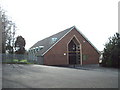
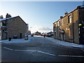
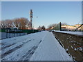
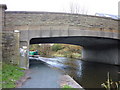
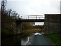
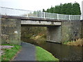
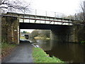
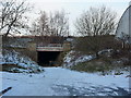
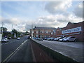
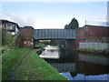
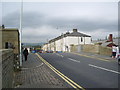
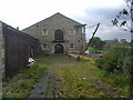
Photos of BB12 6HR
Area Information
BB12 6HR is a small, densely populated residential area within the Borough of Burnley, Lancashire. Covering just 1,660 square metres, it is home to 1,961 people, making it one of the most compact postcode areas in England. The district lies within the historically significant Rosegrove with Lowerhouse Ward, part of Burnley’s broader urban fabric. Its character is shaped by a mix of modern housing and remnants of industrial heritage, such as the former Empire Mill and Imperial Mill on Liverpool Road, now repurposed for retail, offices, and dwellings. Despite its small size, the area offers proximity to Burnley’s amenities while retaining a distinct local identity. Daily life here is defined by a tight-knit community, with residents often walking or cycling to nearby services. The area’s high population density means it is both lively and intimate, with a focus on practical living rather than sprawling development. For those seeking a compact, historically rich environment with easy access to Burnley’s infrastructure, BB12 6HR presents a unique blend of residential and industrial legacy.
- Area Type
- Postcode
- Area Size
- 1660 m²
- Population
- Not available
- Population Density
- Not available
The property market in BB12 6HR is characterised by a high rate of home ownership (56%) and a predominance of houses over flats or apartments. This suggests a market skewed towards owner-occupied homes, with limited rental activity given the small size of the area. The housing stock is largely composed of traditional properties, many of which may date back to the mid-20th century or earlier. The compact nature of the postcode means that property availability is limited, and buyers may face competition for the few available homes. Given the area’s proximity to Burnley’s core, it may appeal to those seeking affordable housing with access to urban amenities. However, the high population density and lack of new developments could constrain future growth in the market.
House Prices in BB12 6HR
Showing 10 properties
| Address | Type | Beds | Baths | Last Sale Price | Last Sale Date | |
|---|---|---|---|---|---|---|
| 7 Mersey Street, Burnley, BB12 6HR | Terraced | 3 | 1 | £90,000 | Jul 2024 | |
| 15 Mersey Street, Burnley, BB12 6HR | house | - | - | £97,500 | Apr 2024 | |
| 13 Mersey Street, Burnley, BB12 6HR | Terraced | 2 | 1 | £65,000 | Nov 2023 | |
| 9 Mersey Street, Burnley, BB12 6HR | house | - | - | £90,500 | Sep 2021 | |
| 3 Mersey Street, Burnley, BB12 6HR | house | - | - | £90,000 | Nov 2015 | |
| 17 Mersey Street, Burnley, BB12 6HR | Terraced | - | - | £72,000 | Jul 2007 | |
| 19 Mersey Street, Burnley, BB12 6HR | Terraced | - | - | £72,000 | Jul 2007 | |
| 5 Mersey Street, Burnley, BB12 6HR | house | 2 | 1 | £75,000 | Jun 2006 | |
| 1 Mersey Street, Burnley, BB12 6HR | house | - | - | - | - | |
| 11 Mersey Street, Burnley, BB12 6HR | Terraced | - | - | - | - |
Energy Efficiency in BB12 6HR
Life in BB12 6HR is shaped by its proximity to Burnley’s amenities and the presence of local retail and transport options. Residents can access nearby shops such as Spar and Farmfoods Rosehill, which cater to everyday needs. The area’s rail network, with five stations within practical reach, offers easy access to employment opportunities and leisure activities beyond the immediate postcode. While the area lacks large parks or recreational spaces, its compact size means that Burnley’s broader green spaces are within short travel distance. The historical character of the district, including former industrial sites repurposed for residential and commercial use, adds a unique dimension to the local environment. The combination of practical amenities and urban connectivity makes BB12 6HR suitable for those prioritising convenience over expansive leisure facilities.
Amenities
Schools
Residents of BB12 6HR have access to several primary and nursery schools, including Rosegrove Nursery School, Burnley Lowerhouse Junior School (rated satisfactory by Ofsted), Rosegrove Infant School (rated good), and two St Augustine of Canterbury Roman Catholic Primary Schools. These institutions provide a range of educational options, though the absence of secondary schools means families may need to travel to Burnley or nearby areas for higher education. The presence of two primary schools with a ‘good’ and ‘satisfactory’ Ofsted rating suggests a generally reliable standard of education, though parents should consider the specific needs of their children when choosing a school. The diversity of options, including both state and faith-based institutions, allows families to select a school that aligns with their values and requirements.
| Rank | School | Type | Entry gender | Ages |
|---|
Explore more schools in this area
Go to Schools tabDemographics
The population of BB12 6HR is predominantly middle-aged, with a median age of 47 and the majority of residents falling within the 30–64 age range. Home ownership is relatively high at 56%, indicating a stable, long-term resident base. The area is primarily composed of houses rather than flats or apartments, reflecting a traditional housing stock. The predominant ethnic group is White, which aligns with broader trends in the Borough of Burnley. With a population density of 1,181,378 people per square kilometre, the area is exceptionally crowded, though this is typical of urban postcode clusters. This density suggests a mix of family homes and smaller properties, with limited space for expansion. The high proportion of adults in the 30–64 age range implies a community focused on established careers and family life, with fewer young children or retirees compared to other areas.
Household Size
Accommodation Type
Tenure
Ethnic Group
Religion
Household Composition
Age
Household Deprivation
NS-SEC
Explore more demographic insights in this area
Go to Demographics tabPlanning
Planning Constraints
- Flood RiskPremium
- Ramsar Wetland SitesPremium
- Area of Outstanding Natural BeautyPremium
- Protected Nature ReservePremium
- Protected WoodlandPremium