Area Overview for BB12 6HP
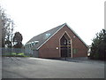
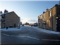
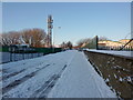
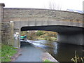
Photos of BB12 6HP
Area Information
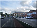
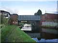
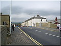
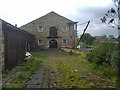
BB12 6HP is a small residential postcode in Burnley, Lancashire, nestled within the historic manor of Ightenhill. With a population of 1,961 spread across 675 square metres, it is one of the most densely populated areas in England, yet retains a compact, community-focused character. The area is part of the Rosegrove with Lowerhouse Ward, a district with roots in Burnley’s industrial past. Historic sites like Empire Mill and Imperial Mill, once key industrial landmarks, now stand as converted retail, office, and residential spaces, blending heritage with modern living. Daily life here is shaped by proximity to Burnley’s urban core, with easy access to rail links and local amenities. The mix of older housing stock and recent conversions creates a unique blend of traditional and contemporary living, appealing to those seeking a balance between history and practicality.
- Area Type
- Postcode
- Area Size
- 675 m²
- Population
- Not available
- Population Density
- Not available
BB12 6HP is characterised by a 56% home ownership rate, with houses forming the dominant accommodation type. This suggests a mix of owner-occupied properties and rental stock, though the small area size means the housing market is limited in scale. The presence of historic buildings like Empire Mill and Imperial Mill, now repurposed for residential and commercial use, adds diversity to the property stock. Buyers should consider the area’s compact nature, which may limit availability of new builds. The focus on houses rather than flats indicates a preference for family-friendly living, aligning with the local demographic of middle-aged residents. Proximity to Burnley’s rail network and schools enhances the area’s appeal for those seeking a balance between urban and suburban living.
House Prices in BB12 6HP
Showing 4 properties
| Address | Type | Beds | Baths | Last Sale Price | Last Sale Date | |
|---|---|---|---|---|---|---|
| 1 Irwell Street, Burnley, BB12 6HP | Terraced | 2 | 1 | £105,000 | Oct 2025 | |
| 2 Irwell Street, Burnley, BB12 6HP | Terraced | 3 | 1 | £76,000 | Jul 2024 | |
| 4 Irwell Street, Burnley, BB12 6HP | Flat | - | - | - | - | |
| 4A Irwell Street, Burnley, BB12 6HP | Flat | 1 | 1 | - | - |
Energy Efficiency in BB12 6HP
Life in BB12 6HP is shaped by its proximity to Burnley’s urban amenities and historic sites. Residents can access five retail outlets, including Spar and Farmfoods, for groceries and essentials. The area’s rail network, with stations like Burnley Manchester Road, offers easy travel to nearby towns. Historic sites such as Empire Mill and Imperial Mill, now converted to residential and commercial spaces, add character to the landscape. While parks and leisure facilities are not explicitly listed, the area’s compact size ensures amenities are within walking distance. The mix of retail, transport, and historical features creates a convenient, lived-in feel for daily routines.
Amenities
Schools
Residents of BB12 6HP have access to a range of schools, including Rosegrove Nursery School, which provides early education, and several primary schools. Burnley Lowerhouse Junior School and St Augustine of Canterbury RC Primary School, A Voluntary Academy offer primary education, with the latter rated as good by Ofsted. Rosegrove Infant School is also rated good, ensuring high standards for early years’ education. The presence of multiple primary schools, including a Roman Catholic institution, reflects the area’s diverse educational options. Families benefit from a mix of state and faith-based schools, though no secondary schools are listed. This clustering of primary education supports local families with children at different stages of schooling.
| Rank | School | Type | Entry gender | Ages |
|---|
Explore more schools in this area
Go to Schools tabDemographics
The population of BB12 6HP is predominantly adults aged 30–64, with a median age of 47. This suggests a community rooted in family life and established careers. Home ownership stands at 56%, with houses being the primary accommodation type. The majority of residents identify as White, reflecting the area’s demographic profile. The high population density—2.9 million people per square kilometre—indicates a compact, closely knit community. While the data does not specify deprivation levels, the concentration of households in a small area may influence local services and infrastructure demand. The age profile implies a steady need for schools, healthcare, and community facilities, which are evident in the nearby amenities.
Household Size
Accommodation Type
Tenure
Ethnic Group
Religion
Household Composition
Age
Household Deprivation
NS-SEC
Explore more demographic insights in this area
Go to Demographics tabPlanning
Planning Constraints
- Flood RiskPremium
- Ramsar Wetland SitesPremium
- Area of Outstanding Natural BeautyPremium
- Protected Nature ReservePremium
- Protected WoodlandPremium