Area Overview for BB10 3RR
Photos of BB10 3RR
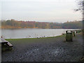
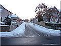
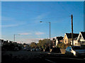
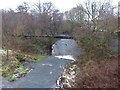
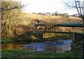
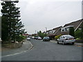
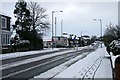
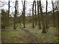
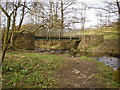
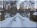
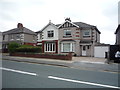
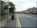
59 photos from this area
Area Information
Key information about the BB10 3RR including its size, population, and administrative classification.
- Area Type
- Postcode
- Area Size
- 12.9 hectares
- Population
- 1394
- Population Density
- 214 people/km²
House Prices in BB10 3RR
52
Properties
£171,974
Average Sold Price
£950
Lowest Price
£397,000
Highest Price
Showing 52 properties
| Address | Type | Beds | Baths | Last Sale Price | Last Sale Date | |
|---|---|---|---|---|---|---|
| 43 Lindsay Park, Worsthorne With Hurstwood, BB10 3RR | Detached | 4 | 2 | £397,000 | Aug 2025 | |
| 17 Lindsay Park, Worsthorne With Hurstwood, BB10 3RR | Bungalow | 3 | 1 | £384,950 | Mar 2025 | |
| 24 Lindsay Park, Worsthorne With Hurstwood, BB10 3RR | house | - | - | £213,000 | Mar 2021 | |
| 44 Lindsay Park, Worsthorne With Hurstwood, BB10 3RR | Detached | 4 | 2 | £249,995 | Jun 2020 | |
| 4 Lindsay Park, Worsthorne With Hurstwood, BB10 3RR | Land | - | - | £165,000 | Nov 2019 | |
| 12 Lindsay Park, Worsthorne With Hurstwood, BB10 3RR | Detached | 4 | 2 | £285,000 | Apr 2019 | |
| 5 Lindsay Park, Worsthorne With Hurstwood, BB10 3RR | Bungalow | - | - | £212,500 | Apr 2019 | |
| 6 Lindsay Park, Worsthorne With Hurstwood, BB10 3RR | Semi-detached | 3 | 2 | £229,500 | Jan 2019 | |
| 28 Lindsay Park, Worsthorne With Hurstwood, BB10 3RR | Detached | 3 | 2 | £230,000 | Apr 2018 | |
| 20 Lindsay Park, Worsthorne With Hurstwood, BB10 3RR | Semi-detached | - | - | £950 | Nov 2017 |
Page 1 of 6
Energy Efficiency in BB10 3RR
Amenities
Schools
| Rank | School | Type | Entry gender | Ages |
|---|
Explore more schools in this area
Go to Schools tabDemographics
Household Size
Two person
most common
Accommodation Type
Houses
most common
Tenure
92
majority
Ethnic Group
White
most common
Religion
N/A
most common
Household Composition
N/A
most common
Age
47
median
Adults (30-64 years)
most common
Household Deprivation
N/A
with no deprivation
NS-SEC
36
in Lower managerial occupations
Explore more demographic insights in this area
Go to Demographics tabPlanning
Planning Constraints
- Flood RiskPremium
- Ramsar Wetland SitesPremium
- Area of Outstanding Natural BeautyPremium
- Protected Nature ReservePremium
- Protected WoodlandPremium