Area Overview for BB10 3NS
Photos of BB10 3NS
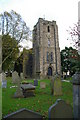
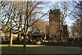
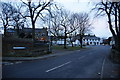
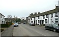
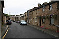
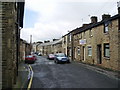
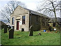
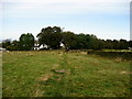
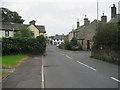
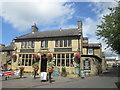
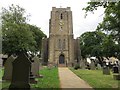
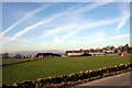
39 photos from this area
Area Information
Key information about the BB10 3NS including its size, population, and administrative classification.
- Area Type
- Postcode
- Area Size
- 6.7 hectares
- Population
- 1164
- Population Density
- 88 people/km²
House Prices in BB10 3NS
26
Properties
£148,350
Average Sold Price
£84,000
Lowest Price
£282,500
Highest Price
Showing 26 properties
| Address | Type | Beds | Baths | Last Sale Price | Last Sale Date | |
|---|---|---|---|---|---|---|
| 12 Old Hall Square, Worsthorne With Hurstwood, BB10 3NS | house | - | - | £120,000 | Aug 2022 | |
| 8 Old Hall Square, Worsthorne With Hurstwood, BB10 3NS | house | - | - | £140,000 | Sep 2018 | |
| 16 Old Hall Square, Worsthorne With Hurstwood, BB10 3NS | Semi-detached | - | - | £160,000 | Dec 2012 | |
| 9 Old Hall Square, Worsthorne With Hurstwood, BB10 3NS | house | - | - | £125,000 | Aug 2011 | |
| 10 Old Hall Square, Worsthorne With Hurstwood, BB10 3NS | house | - | - | £166,000 | Jun 2010 | |
| 15 Old Hall Square, Worsthorne With Hurstwood, BB10 3NS | house | - | - | £155,000 | Oct 2009 | |
| 11 Old Hall Square, Worsthorne With Hurstwood, BB10 3NS | Detached | 3 | 1 | £125,000 | Mar 2009 | |
| 17 Old Hall Square, Worsthorne With Hurstwood, BB10 3NS | Semi-detached | - | - | £126,000 | Mar 2005 | |
| Old Hall Farm, Old Hall Square, Worsthorne With Hurstwood, BB10 3NS | Detached | 3 | 2 | £282,500 | Dec 2003 | |
| 24 Old Hall Square, Worsthorne With Hurstwood, BB10 3NS | Semi-detached | - | - | £84,000 | Mar 2003 |
Page 1 of 3
Energy Efficiency in BB10 3NS
Amenities
Schools
| Rank | School | Type | Entry gender | Ages |
|---|
Explore more schools in this area
Go to Schools tabDemographics
Household Size
Two person
most common
Accommodation Type
Houses
most common
Tenure
79
majority
Ethnic Group
White
most common
Religion
N/A
most common
Household Composition
N/A
most common
Age
47
median
Adults (30-64 years)
most common
Household Deprivation
N/A
with no deprivation
NS-SEC
40
in Lower managerial occupations
Explore more demographic insights in this area
Go to Demographics tabPlanning
Planning Constraints
- Flood RiskPremium
- Ramsar Wetland SitesPremium
- Area of Outstanding Natural BeautyPremium
- Protected Nature ReservePremium
- Protected WoodlandPremium