Area Overview for BB10 2JT
Photos of BB10 2JT
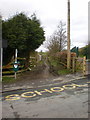
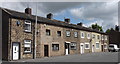
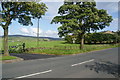
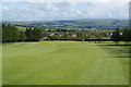
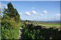
29 photos from this area
Area Information
Key information about the BB10 2JT including its size, population, and administrative classification.
- Area Type
- Postcode
- Area Size
- 3.8 hectares
- Population
- 1368
- Population Density
- 84 people/km²
House Prices in BB10 2JT
33
Properties
£133,993
Average Sold Price
£45,000
Lowest Price
£210,000
Highest Price
Showing 33 properties
| Address | Type | Beds | Baths | Last Sale Price | Last Sale Date | |
|---|---|---|---|---|---|---|
| 30 Tiverton Drive, Briercliffe, BB10 2JT | Semi-detached | 3 | 1 | £210,000 | Feb 2024 | |
| 24 Tiverton Drive, Briercliffe, BB10 2JT | Retail | 3 | 1 | £168,000 | Feb 2023 | |
| 38 Tiverton Drive, Briercliffe, BB10 2JT | Semi-detached | 3 | 1 | £165,000 | Aug 2019 | |
| 33 Tiverton Drive, Briercliffe, BB10 2JT | Detached | 3 | 1 | £174,950 | Apr 2019 | |
| 20 Tiverton Drive, Briercliffe, BB10 2JT | Semi-detached | 3 | 2 | £179,000 | Oct 2018 | |
| 16 Tiverton Drive, Briercliffe, BB10 2JT | Semi-detached | 4 | 2 | £140,000 | Mar 2016 | |
| 2 Tiverton Drive, Briercliffe, BB10 2JT | Semi-detached | 3 | - | £165,000 | Jun 2014 | |
| 36 Tiverton Drive, Briercliffe, BB10 2JT | Semi-detached | 3 | - | £129,995 | Oct 2013 | |
| 28 Tiverton Drive, Briercliffe, BB10 2JT | house | - | - | £151,500 | Feb 2012 | |
| 18 Tiverton Drive, Briercliffe, BB10 2JT | house | - | - | £112,000 | Jan 2011 |
Page 1 of 4
Energy Efficiency in BB10 2JT
Amenities
Schools
| Rank | School | Type | Entry gender | Ages |
|---|
Explore more schools in this area
Go to Schools tabDemographics
Household Size
Two person
most common
Accommodation Type
Houses
most common
Tenure
80
majority
Ethnic Group
White
most common
Religion
N/A
most common
Household Composition
N/A
most common
Age
47
median
Adults (30-64 years)
most common
Household Deprivation
N/A
with no deprivation
NS-SEC
36
in Lower managerial occupations
Explore more demographic insights in this area
Go to Demographics tabPlanning
Planning Constraints
- Flood RiskPremium
- Ramsar Wetland SitesPremium
- Area of Outstanding Natural BeautyPremium
- Protected Nature ReservePremium
- Protected WoodlandPremium