Area Overview for BB1 2JA
Photos of BB1 2JA
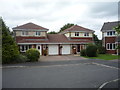
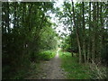
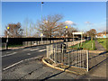
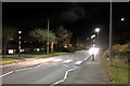
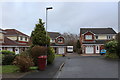
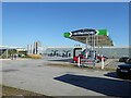
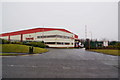
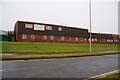
19 photos from this area
Area Information
Key information about the BB1 2JA including its size, population, and administrative classification.
- Area Type
- Postcode
- Area Size
- 1.1 hectares
- Population
- 1637
- Population Density
- 5694 people/km²
House Prices in BB1 2JA
28
Properties
£79,553
Average Sold Price
£11,040
Lowest Price
£140,000
Highest Price
Showing 28 properties
| Address | Type | Beds | Baths | Last Sale Price | Last Sale Date | |
|---|---|---|---|---|---|---|
| 214 Rothesay Road, Blackburn, BB1 2JA | house | - | - | £140,000 | Jul 2022 | |
| 212 Rothesay Road, Blackburn, BB1 2JA | Retail | 2 | 1 | £121,100 | May 2022 | |
| 210 Rothesay Road, Blackburn, BB1 2JA | house | - | - | £119,000 | Oct 2021 | |
| 198 Rothesay Road, Blackburn, BB1 2JA | Semi-detached | 2 | 1 | £93,000 | Aug 2019 | |
| 196 Rothesay Road, Blackburn, BB1 2JA | Semi-detached | 3 | 1 | £65,000 | Jul 2017 | |
| 174 Rothesay Road, Blackburn, BB1 2JA | Semi-detached | 2 | 1 | £60,000 | Jun 2010 | |
| 190 Rothesay Road, Blackburn, BB1 2JA | house | - | - | £95,000 | Apr 2008 | |
| 224 Rothesay Road, Blackburn, BB1 2JA | house | - | - | £90,000 | May 2007 | |
| 222 Rothesay Road, Blackburn, BB1 2JA | Semi-detached | - | - | £80,000 | Dec 2006 | |
| 188 Rothesay Road, Blackburn, BB1 2JA | Semi-detached | - | - | £65,000 | Apr 2005 |
Page 1 of 3
Energy Efficiency in BB1 2JA
Amenities
Schools
| Rank | School | Type | Entry gender | Ages |
|---|
Explore more schools in this area
Go to Schools tabDemographics
Household Size
Family (3-5 people)
most common
Accommodation Type
Houses
most common
Tenure
34
majority
Ethnic Group
White
most common
Religion
N/A
most common
Household Composition
N/A
most common
Age
47
median
Adults (30-64 years)
most common
Household Deprivation
N/A
with no deprivation
NS-SEC
12
in Lower managerial occupations
Explore more demographic insights in this area
Go to Demographics tabPlanning
Planning Constraints
- Flood RiskPremium
- Ramsar Wetland SitesPremium
- Area of Outstanding Natural BeautyPremium
- Protected Nature ReservePremium
- Protected WoodlandPremium