Area Overview for TS6 9NE
Photos of TS6 9NE

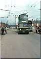
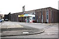
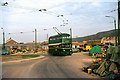
4 photos from this area
Area Information
Key information about the TS6 9NE including its size, population, and administrative classification.
- Area Type
- Postcode
- Area Size
- 2.6 hectares
- Population
- 1425
- Population Density
- 4281 people/km²
House Prices in TS6 9NE
35
Properties
£98,904
Average Sold Price
£39,000
Lowest Price
£152,000
Highest Price
Showing 35 properties
| Address | Type | Beds | Baths | Last Sale Price | Last Sale Date | |
|---|---|---|---|---|---|---|
| 47 Ripon Way, Eston, TS6 9NE | Bungalow | 2 | - | £85,000 | Nov 2024 | |
| 41 Ripon Way, Eston, TS6 9NE | Bungalow | - | - | £75,000 | May 2023 | |
| 19 Ripon Way, Eston, TS6 9NE | Semi-detached | 3 | 1 | £143,000 | May 2023 | |
| 31 Ripon Way, Eston, TS6 9NE | Bungalow | 2 | - | £152,000 | Jan 2023 | |
| 43 Ripon Way, Eston, TS6 9NE | Semi-detached | 2 | 1 | £150,000 | Jan 2023 | |
| 65 Ripon Way, Eston, TS6 9NE | house | 2 | 1 | £121,000 | Feb 2022 | |
| 45 Ripon Way, Eston, TS6 9NE | Bungalow | - | - | £90,000 | May 2019 | |
| 1 Ripon Way, Eston, TS6 9NE | house | - | - | £107,000 | Jan 2018 | |
| 35 Ripon Way, Eston, TS6 9NE | Semi-detached | 4 | - | £103,000 | Oct 2017 | |
| 55 Ripon Way, Eston, TS6 9NE | house | - | - | £94,400 | May 2017 |
Page 1 of 4
Energy Efficiency in TS6 9NE
Amenities
Schools
| Rank | School | Type | Entry gender | Ages |
|---|
Explore more schools in this area
Go to Schools tabDemographics
Household Size
One person
most common
Accommodation Type
Houses
most common
Tenure
51
majority
Ethnic Group
White
most common
Religion
N/A
most common
Household Composition
N/A
most common
Age
47
median
Adults (30-64 years)
most common
Household Deprivation
N/A
with no deprivation
NS-SEC
15
in Lower managerial occupations
Explore more demographic insights in this area
Go to Demographics tabPlanning
Planning Constraints
- Flood RiskPremium
- Ramsar Wetland SitesPremium
- Area of Outstanding Natural BeautyPremium
- Protected Nature ReservePremium
- Protected WoodlandPremium