Area Overview for TS6 8HW
Photos of TS6 8HW


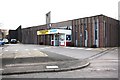

4 photos from this area
Area Information
Key information about the TS6 8HW including its size, population, and administrative classification.
- Area Type
- Postcode
- Area Size
- 2.4 hectares
- Population
- 1425
- Population Density
- 4281 people/km²
House Prices in TS6 8HW
17
Properties
£69,710
Average Sold Price
£30,000
Lowest Price
£95,000
Highest Price
Showing 17 properties
| Address | Type | Beds | Baths | Last Sale Price | Last Sale Date | |
|---|---|---|---|---|---|---|
| 46 Grosmont Road, Eston, TS6 8HW | house | - | - | £50,000 | Sep 2024 | |
| 64 Grosmont Road, Eston, TS6 8HW | house | 3 | - | £90,000 | Feb 2024 | |
| 62 Grosmont Road, Eston, TS6 8HW | Terraced | 3 | 1 | £85,000 | Sep 2022 | |
| 38 Grosmont Road, Eston, TS6 8HW | Retail | 3 | 1 | £60,500 | Jun 2022 | |
| 42 Grosmont Road, Eston, TS6 8HW | Semi-detached | 2 | 1 | £62,000 | Dec 2020 | |
| 48 Grosmont Road, Eston, TS6 8HW | house | 2 | - | £57,000 | Oct 2018 | |
| 56 Grosmont Road, Eston, TS6 8HW | house | - | - | £95,000 | Jun 2015 | |
| 52 Grosmont Road, Eston, TS6 8HW | house | - | - | £77,600 | Jun 2011 | |
| 66 Grosmont Road, Eston, TS6 8HW | Semi-detached | - | - | £90,000 | Jul 2006 | |
| 36 Grosmont Road, Eston, TS6 8HW | Semi-detached | - | - | £30,000 | Sep 1997 |
Page 1 of 2
Energy Efficiency in TS6 8HW
Amenities
Schools
| Rank | School | Type | Entry gender | Ages |
|---|
Explore more schools in this area
Go to Schools tabDemographics
Household Size
One person
most common
Accommodation Type
Houses
most common
Tenure
51
majority
Ethnic Group
White
most common
Religion
N/A
most common
Household Composition
N/A
most common
Age
47
median
Adults (30-64 years)
most common
Household Deprivation
N/A
with no deprivation
NS-SEC
15
in Lower managerial occupations
Explore more demographic insights in this area
Go to Demographics tabPlanning
Planning Constraints
- Flood RiskPremium
- Ramsar Wetland SitesPremium
- Area of Outstanding Natural BeautyPremium
- Protected Nature ReservePremium
- Protected WoodlandPremium