Area Overview for TS6 0AT
Photos of TS6 0AT

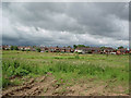
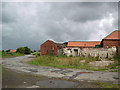
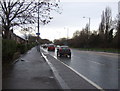
16 photos from this area
Area Information
Key information about the TS6 0AT including its size, population, and administrative classification.
- Area Type
- Postcode
- Area Size
- 1.1 hectares
- Population
- 2116
- Population Density
- 1917 people/km²
House Prices in TS6 0AT
29
Properties
£78,095
Average Sold Price
£29,000
Lowest Price
£118,000
Highest Price
Showing 29 properties
| Address | Type | Beds | Baths | Last Sale Price | Last Sale Date | |
|---|---|---|---|---|---|---|
| 41 Kingsway Avenue, Teesville, TS6 0AT | house | - | - | £110,000 | Jul 2021 | |
| 40 Kingsway Avenue, Teesville, TS6 0AT | house | - | - | £97,000 | Jul 2021 | |
| 35 Kingsway Avenue, Teesville, TS6 0AT | Semi-detached | 3 | 1 | £77,000 | Feb 2021 | |
| 36 Kingsway Avenue, Teesville, TS6 0AT | Semi-detached | 3 | 1 | £104,000 | Mar 2016 | |
| 18 Kingsway Avenue, Teesville, TS6 0AT | Semi-detached | 3 | 1 | £110,000 | Nov 2015 | |
| 16 Kingsway Avenue, Teesville, TS6 0AT | house | - | - | £118,000 | Aug 2012 | |
| 31 Kingsway Avenue, Teesville, TS6 0AT | house | - | - | £110,000 | Apr 2010 | |
| 33 Kingsway Avenue, Teesville, TS6 0AT | Semi-detached | - | - | £83,528 | Mar 2008 | |
| 34 Kingsway Avenue, Teesville, TS6 0AT | Semi-detached | - | - | £100,000 | Dec 2007 | |
| 8 Kingsway Avenue, Teesville, TS6 0AT | Semi-detached | - | - | £59,995 | Jan 2003 |
Page 1 of 3
Energy Efficiency in TS6 0AT
Amenities
Schools
| Rank | School | Type | Entry gender | Ages |
|---|
Explore more schools in this area
Go to Schools tabDemographics
Household Size
Family (3-5 people)
most common
Accommodation Type
Houses
most common
Tenure
78
majority
Ethnic Group
White
most common
Religion
N/A
most common
Household Composition
N/A
most common
Age
47
median
Adults (30-64 years)
most common
Household Deprivation
N/A
with no deprivation
NS-SEC
25
in Lower managerial occupations
Explore more demographic insights in this area
Go to Demographics tabPlanning
Planning Constraints
- Flood RiskPremium
- Ramsar Wetland SitesPremium
- Area of Outstanding Natural BeautyPremium
- Protected Nature ReservePremium
- Protected WoodlandPremium