Area Overview for TS25 2JP
Photos of TS25 2JP
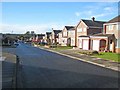
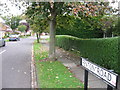
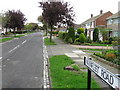
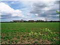
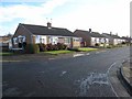
10 photos from this area
Area Information
Key information about the TS25 2JP including its size, population, and administrative classification.
- Area Type
- Postcode
- Area Size
- 2.6 hectares
- Population
- 1285
- Population Density
- 4504 people/km²
House Prices in TS25 2JP
59
Properties
£120,517
Average Sold Price
£50,000
Lowest Price
£245,000
Highest Price
Showing 59 properties
| Address | Type | Beds | Baths | Last Sale Price | Last Sale Date | |
|---|---|---|---|---|---|---|
| 135 Spalding Road, Hartlepool, TS25 2JP | Semi-detached | 2 | 1 | £170,000 | Mar 2023 | |
| 78 Spalding Road, Hartlepool, TS25 2JP | house | - | - | £222,000 | May 2021 | |
| 139 Spalding Road, Hartlepool, TS25 2JP | Bungalow | 2 | 1 | £129,000 | Jun 2020 | |
| 88 Spalding Road, Hartlepool, TS25 2JP | Semi-detached | - | - | £132,000 | Jan 2020 | |
| 100 Spalding Road, Hartlepool, TS25 2JP | Semi-detached | 3 | 1 | £180,000 | Aug 2019 | |
| 128 Spalding Road, Hartlepool, TS25 2JP | house | - | - | £180,000 | Jul 2019 | |
| 102 Spalding Road, Hartlepool, TS25 2JP | house | - | - | £150,000 | Jun 2019 | |
| 116 Spalding Road, Hartlepool, TS25 2JP | house | - | - | £122,500 | Aug 2018 | |
| 131 Spalding Road, Hartlepool, TS25 2JP | Bungalow | - | - | £145,000 | Aug 2018 | |
| 129 Spalding Road, Hartlepool, TS25 2JP | Bungalow | - | - | £95,000 | May 2018 |
Page 1 of 6
Energy Efficiency in TS25 2JP
Amenities
Schools
| Rank | School | Type | Entry gender | Ages |
|---|
Explore more schools in this area
Go to Schools tabDemographics
Household Size
Two person
most common
Accommodation Type
Houses
most common
Tenure
92
majority
Ethnic Group
White
most common
Religion
N/A
most common
Household Composition
N/A
most common
Age
47
median
Elderly (65+ years)
most common
Household Deprivation
N/A
with no deprivation
NS-SEC
31
in Lower managerial occupations
Explore more demographic insights in this area
Go to Demographics tabPlanning
Planning Constraints
- Flood RiskPremium
- Ramsar Wetland SitesPremium
- Area of Outstanding Natural BeautyPremium
- Protected Nature ReservePremium
- Protected WoodlandPremium