Area Overview for TS25 2JN
Photos of TS25 2JN
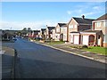
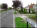
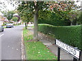
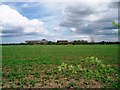
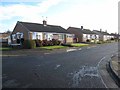
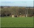
10 photos from this area
Area Information
Key information about the TS25 2JN including its size, population, and administrative classification.
- Area Type
- Postcode
- Area Size
- 1.8 hectares
- Population
- 1285
- Population Density
- 4504 people/km²
House Prices in TS25 2JN
30
Properties
£149,390
Average Sold Price
£59,000
Lowest Price
£350,000
Highest Price
Showing 30 properties
| Address | Type | Beds | Baths | Last Sale Price | Last Sale Date | |
|---|---|---|---|---|---|---|
| 101 Crowland Road, Hartlepool, TS25 2JN | Semi-detached | 2 | 1 | £189,950 | Mar 2025 | |
| 83 Crowland Road, Hartlepool, TS25 2JN | Semi-detached | 3 | 1 | £182,000 | Mar 2025 | |
| 61 Crowland Road, Hartlepool, TS25 2JN | Detached | 4 | 2 | £350,000 | Feb 2025 | |
| 97 Crowland Road, Hartlepool, TS25 2JN | Semi-detached | 2 | 1 | £165,000 | Jan 2023 | |
| 95 Crowland Road, Hartlepool, TS25 2JN | Semi-detached | - | - | £64,000 | Feb 2022 | |
| 89 Crowland Road, Hartlepool, TS25 2JN | Bungalow | - | - | £124,500 | Dec 2021 | |
| 99 Crowland Road, Hartlepool, TS25 2JN | Bungalow | - | - | £135,000 | May 2021 | |
| 67 Crowland Road, Hartlepool, TS25 2JN | house | - | - | £169,950 | Feb 2021 | |
| 36 Crowland Road, Hartlepool, TS25 2JN | Bungalow | - | - | £145,000 | Jun 2019 | |
| 34 Crowland Road, Hartlepool, TS25 2JN | Bungalow | 3 | 1 | £129,950 | Nov 2016 |
Page 1 of 3
Energy Efficiency in TS25 2JN
Amenities
Schools
| Rank | School | Type | Entry gender | Ages |
|---|
Explore more schools in this area
Go to Schools tabDemographics
Household Size
Two person
most common
Accommodation Type
Houses
most common
Tenure
92
majority
Ethnic Group
White
most common
Religion
N/A
most common
Household Composition
N/A
most common
Age
47
median
Elderly (65+ years)
most common
Household Deprivation
N/A
with no deprivation
NS-SEC
31
in Lower managerial occupations
Explore more demographic insights in this area
Go to Demographics tabPlanning
Planning Constraints
- Flood RiskPremium
- Ramsar Wetland SitesPremium
- Area of Outstanding Natural BeautyPremium
- Protected Nature ReservePremium
- Protected WoodlandPremium