Area Overview for TS21 2BL
Photos of TS21 2BL
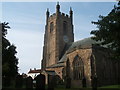
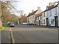
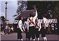
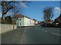
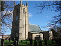
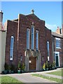
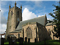
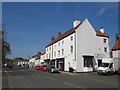
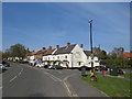
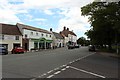
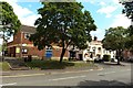
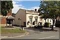
100 photos from this area
Area Information
Key information about the TS21 2BL including its size, population, and administrative classification.
- Area Type
- Postcode
- Area Size
- 3270 m²
- Population
- 1856
- Population Density
- 1895 people/km²
House Prices in TS21 2BL
9
Properties
£199,615
Average Sold Price
£61,750
Lowest Price
£425,000
Highest Price
Showing 9 properties
| Address | Type | Beds | Baths | Last Sale Price | Last Sale Date | |
|---|---|---|---|---|---|---|
| 8 Rectory Row, Sedgefield, TS21 2BL | Terraced | 5 | 3 | £408,000 | Mar 2025 | |
| 3 Rectory Row, Sedgefield, TS21 2BL | Terraced | 2 | 1 | £170,000 | Dec 2024 | |
| 2 Rectory Row, Sedgefield, TS21 2BL | house | - | - | £129,950 | Apr 2022 | |
| 1 Rectory Row, Sedgefield, TS21 2BL | house | - | - | £112,000 | Aug 2021 | |
| 9 Rectory Row, Sedgefield, TS21 2BL | house | 3 | - | £425,000 | May 2021 | |
| 5 Rectory Row, Sedgefield, TS21 2BL | Terraced | - | - | £168,220 | Aug 2004 | |
| 4 Rectory Row, Sedgefield, TS21 2BL | Terraced | - | - | £61,750 | Aug 1999 | |
| 10 Rectory Row, Sedgefield, TS21 2BL | Terraced | - | - | £122,000 | May 1996 | |
| 39 West End, Sedgefield, TS21 2BL | Terraced | - | - | - | - |
Energy Efficiency in TS21 2BL
Amenities
Schools
| Rank | School | Type | Entry gender | Ages |
|---|
Explore more schools in this area
Go to Schools tabDemographics
Household Size
One person
most common
Accommodation Type
Houses
most common
Tenure
66
majority
Ethnic Group
White
most common
Religion
N/A
most common
Household Composition
N/A
most common
Age
47
median
Adults (30-64 years)
most common
Household Deprivation
N/A
with no deprivation
NS-SEC
40
in Lower managerial occupations
Explore more demographic insights in this area
Go to Demographics tabPlanning
Planning Constraints
- Flood RiskPremium
- Ramsar Wetland SitesPremium
- Area of Outstanding Natural BeautyPremium
- Protected Nature ReservePremium
- Protected WoodlandPremium