Area Overview for TS10 3NB
Photos of TS10 3NB

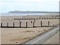
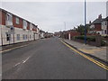
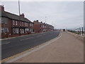
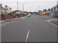
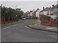
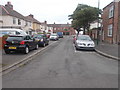
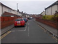
81 photos from this area
Area Information
Key information about the TS10 3NB including its size, population, and administrative classification.
- Area Type
- Postcode
- Area Size
- 5685 m²
- Population
- 1402
- Population Density
- 5117 people/km²
House Prices in TS10 3NB
17
Properties
£96,783
Average Sold Price
£28,500
Lowest Price
£139,950
Highest Price
Showing 17 properties
| Address | Type | Beds | Baths | Last Sale Price | Last Sale Date | |
|---|---|---|---|---|---|---|
| 46 Lime Road, Redcar, TS10 3NB | Terraced | 3 | 1 | £139,950 | Sep 2025 | |
| 52 Lime Road, Redcar, TS10 3NB | house | 2 | 1 | £108,500 | Jul 2024 | |
| 48 Lime Road, Redcar, TS10 3NB | house | - | - | £112,500 | Jul 2024 | |
| 58 Lime Road, Redcar, TS10 3NB | house | - | - | £99,950 | Jan 2021 | |
| 38 Lime Road, Redcar, TS10 3NB | house | - | - | £122,000 | Jan 2017 | |
| 70 Lime Road, Redcar, TS10 3NB | house | - | - | £100,000 | Jan 2015 | |
| 50 Lime Road, Redcar, TS10 3NB | house | 2 | - | £74,500 | Dec 2014 | |
| 60 Lime Road, Redcar, TS10 3NB | house | - | - | £89,995 | Feb 2011 | |
| 54 Lime Road, Redcar, TS10 3NB | Semi-detached | - | - | £125,000 | Aug 2007 | |
| 44 Lime Road, Redcar, TS10 3NB | Semi-detached | - | - | £118,000 | Mar 2007 |
Page 1 of 2
Energy Efficiency in TS10 3NB
Amenities
Schools
| Rank | School | Type | Entry gender | Ages |
|---|
Explore more schools in this area
Go to Schools tabDemographics
Household Size
Two person
most common
Accommodation Type
Houses
most common
Tenure
71
majority
Ethnic Group
White
most common
Religion
N/A
most common
Household Composition
N/A
most common
Age
47
median
Adults (30-64 years)
most common
Household Deprivation
N/A
with no deprivation
NS-SEC
23
in Lower managerial occupations
Explore more demographic insights in this area
Go to Demographics tabPlanning
Planning Constraints
- Flood RiskPremium
- Ramsar Wetland SitesPremium
- Area of Outstanding Natural BeautyPremium
- Protected Nature ReservePremium
- Protected WoodlandPremium