Area Overview for SR7 7WL
Photos of SR7 7WL

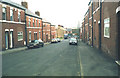
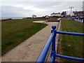

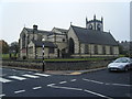


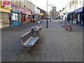
72 photos from this area
Area Information
Key information about the SR7 7WL including its size, population, and administrative classification.
- Area Type
- Postcode
- Area Size
- 3.2 hectares
- Population
- 2007
- Population Density
- 741 people/km²
House Prices in SR7 7WL
27
Properties
£396,424
Average Sold Price
£105,000
Lowest Price
£575,000
Highest Price
Showing 27 properties
| Address | Type | Beds | Baths | Last Sale Price | Last Sale Date | |
|---|---|---|---|---|---|---|
| 9 Boulmer Lea, Seaham, SR7 7WL | house | 6 | 5 | £575,000 | Mar 2025 | |
| 5 Boulmer Lea, Seaham, SR7 7WL | Detached | 6 | - | £445,000 | Feb 2022 | |
| 19 Boulmer Lea, Seaham, SR7 7WL | Detached | 6 | - | £519,250 | Dec 2021 | |
| 25 Boulmer Lea, Seaham, SR7 7WL | Bungalow | - | - | £370,000 | Nov 2021 | |
| 11 Boulmer Lea, Seaham, SR7 7WL | Detached | 6 | - | £515,000 | Jun 2021 | |
| 26 Boulmer Lea, Seaham, SR7 7WL | house | - | - | £440,000 | Jun 2021 | |
| 21 Boulmer Lea, Seaham, SR7 7WL | Detached | 4 | - | £465,000 | May 2021 | |
| 27 Boulmer Lea, Seaham, SR7 7WL | house | - | - | £470,000 | Mar 2021 | |
| 24 Boulmer Lea, Seaham, SR7 7WL | Detached | 5 | 1 | £490,000 | Nov 2020 | |
| 2 Boulmer Lea, Seaham, SR7 7WL | Detached | 6 | 1 | £398,000 | Mar 2019 |
Page 1 of 3
Energy Efficiency in SR7 7WL
Amenities
Schools
| Rank | School | Type | Entry gender | Ages |
|---|
Explore more schools in this area
Go to Schools tabDemographics
Household Size
Family (3-5 people)
most common
Accommodation Type
Houses
most common
Tenure
85
majority
Ethnic Group
White
most common
Religion
N/A
most common
Household Composition
N/A
most common
Age
47
median
Adults (30-64 years)
most common
Household Deprivation
N/A
with no deprivation
NS-SEC
45
in Lower managerial occupations
Explore more demographic insights in this area
Go to Demographics tabPlanning
Planning Constraints
- Flood RiskPremium
- Ramsar Wetland SitesPremium
- Area of Outstanding Natural BeautyPremium
- Protected Nature ReservePremium
- Protected WoodlandPremium