Area Overview for SR7 7EB
Photos of SR7 7EB
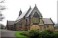
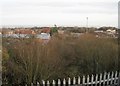
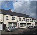
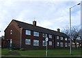
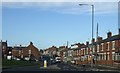
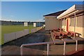
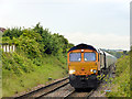
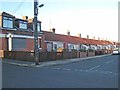
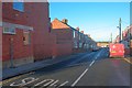
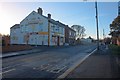
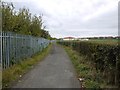
11 photos from this area
Area Information
Key information about the SR7 7EB including its size, population, and administrative classification.
- Area Type
- Postcode
- Area Size
- 2.4 hectares
- Population
- 2007
- Population Density
- 741 people/km²
House Prices in SR7 7EB
52
Properties
£143,011
Average Sold Price
£68,000
Lowest Price
£249,950
Highest Price
Showing 52 properties
| Address | Type | Beds | Baths | Last Sale Price | Last Sale Date | |
|---|---|---|---|---|---|---|
| 29 Mariners Way, Seaham, SR7 7EB | Terraced | 2 | 1 | £116,000 | Jun 2024 | |
| 28 Mariners Way, Seaham, SR7 7EB | Semi-detached | 3 | 2 | £170,000 | Jun 2024 | |
| 1 Mariners Way, Seaham, SR7 7EB | Semi-detached | 2 | 1 | £117,000 | May 2024 | |
| 37 Mariners Way, Seaham, SR7 7EB | house | 4 | 2 | £185,000 | Apr 2024 | |
| 5 Mariners Way, Seaham, SR7 7EB | house | - | - | £168,000 | Jan 2024 | |
| 42 Mariners Way, Seaham, SR7 7EB | Retail | 4 | 2 | £225,000 | Jan 2023 | |
| 45 Mariners Way, Seaham, SR7 7EB | house | 3 | 2 | £175,000 | Oct 2022 | |
| 36 Mariners Way, Seaham, SR7 7EB | Detached | 4 | 2 | £249,950 | Jun 2022 | |
| 44 Mariners Way, Seaham, SR7 7EB | house | - | - | £230,000 | May 2022 | |
| 39 Mariners Way, Seaham, SR7 7EB | Terraced | 4 | 1 | £210,000 | Nov 2021 |
Page 1 of 6
Energy Efficiency in SR7 7EB
Amenities
Schools
| Rank | School | Type | Entry gender | Ages |
|---|
Explore more schools in this area
Go to Schools tabDemographics
Household Size
Family (3-5 people)
most common
Accommodation Type
Houses
most common
Tenure
85
majority
Ethnic Group
White
most common
Religion
N/A
most common
Household Composition
N/A
most common
Age
47
median
Adults (30-64 years)
most common
Household Deprivation
N/A
with no deprivation
NS-SEC
45
in Lower managerial occupations
Explore more demographic insights in this area
Go to Demographics tabPlanning
Planning Constraints
- Flood RiskPremium
- Ramsar Wetland SitesPremium
- Area of Outstanding Natural BeautyPremium
- Protected Nature ReservePremium
- Protected WoodlandPremium