Area Overview for SR2 9BD
Photos of SR2 9BD
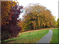

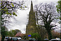
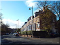
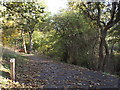
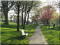
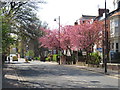
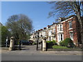
46 photos from this area
Area Information
Key information about the SR2 9BD including its size, population, and administrative classification.
- Area Type
- Postcode
- Area Size
- 7717 m²
- Population
- 1372
- Population Density
- 4569 people/km²
House Prices in SR2 9BD
16
Properties
£186,713
Average Sold Price
£64,000
Lowest Price
£285,000
Highest Price
Showing 16 properties
| Address | Type | Beds | Baths | Last Sale Price | Last Sale Date | |
|---|---|---|---|---|---|---|
| 130 Tunstall Road, Sunderland, SR2 9BD | Semi-detached | 3 | 1 | £248,000 | Jan 2025 | |
| 102 Tunstall Road, Sunderland, SR2 9BD | house | - | - | £160,000 | Feb 2022 | |
| 104 Tunstall Road, Sunderland, SR2 9BD | Semi-detached | 3 | 2 | £174,950 | Jun 2021 | |
| 118 Tunstall Road, Sunderland, SR2 9BD | Semi-detached | 2 | 1 | £208,000 | Apr 2020 | |
| 132 Tunstall Road, Sunderland, SR2 9BD | Semi-detached | 4 | 2 | £285,000 | Jul 2019 | |
| 124 Tunstall Road, Sunderland, SR2 9BD | Semi-detached | 3 | - | £162,500 | Sep 2017 | |
| 110 Tunstall Road, Sunderland, SR2 9BD | Semi-detached | 4 | - | £275,000 | Jan 2017 | |
| 114 Tunstall Road, Sunderland, SR2 9BD | house | - | - | £180,000 | Jun 2016 | |
| 120 Tunstall Road, Sunderland, SR2 9BD | house | - | - | £280,000 | Mar 2015 | |
| 112 Tunstall Road, Sunderland, SR2 9BD | Semi-detached | - | - | £125,100 | Jul 2003 |
Page 1 of 2
Energy Efficiency in SR2 9BD
Amenities
Schools
| Rank | School | Type | Entry gender | Ages |
|---|
Explore more schools in this area
Go to Schools tabDemographics
Household Size
Two person
most common
Accommodation Type
Houses
most common
Tenure
88
majority
Ethnic Group
White
most common
Religion
N/A
most common
Household Composition
N/A
most common
Age
47
median
Adults (30-64 years)
most common
Household Deprivation
N/A
with no deprivation
NS-SEC
46
in Lower managerial occupations
Explore more demographic insights in this area
Go to Demographics tabPlanning
Planning Constraints
- Flood RiskPremium
- Ramsar Wetland SitesPremium
- Area of Outstanding Natural BeautyPremium
- Protected Nature ReservePremium
- Protected WoodlandPremium