Area Overview for SR2 7PW
Photos of SR2 7PW

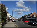
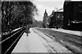
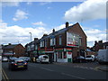
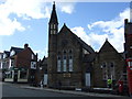
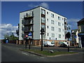
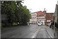
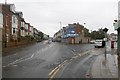
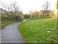
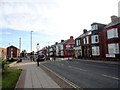
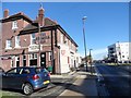
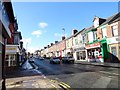
36 photos from this area
Area Information
Key information about the SR2 7PW including its size, population, and administrative classification.
- Area Type
- Postcode
- Area Size
- 4439 m²
- Population
- 1856
- Population Density
- 5491 people/km²
House Prices in SR2 7PW
31
Properties
£100,469
Average Sold Price
£35,000
Lowest Price
£147,000
Highest Price
Showing 31 properties
| Address | Type | Beds | Baths | Last Sale Price | Last Sale Date | |
|---|---|---|---|---|---|---|
| 9 The Retreat, Sunderland, SR2 7PW | Terraced | 3 | 2 | £125,000 | May 2025 | |
| 13 The Retreat, Sunderland, SR2 7PW | Terraced | 4 | 2 | £147,000 | May 2024 | |
| 27 The Retreat, Sunderland, SR2 7PW | Terraced | 3 | 1 | £85,000 | Dec 2023 | |
| 2 The Retreat, Sunderland, SR2 7PW | Terraced | 6 | 1 | £100,000 | Nov 2023 | |
| 25 The Retreat, Sunderland, SR2 7PW | house | 3 | - | £80,600 | Mar 2022 | |
| 31 The Retreat, Sunderland, SR2 7PW | Terraced | 4 | 1 | £130,000 | Dec 2021 | |
| 8 The Retreat, Sunderland, SR2 7PW | Terraced | 4 | 1 | £90,000 | Jan 2019 | |
| 23 The Retreat, Sunderland, SR2 7PW | Terraced | 1 | 2 | £140,000 | Aug 2017 | |
| 21 The Retreat, Sunderland, SR2 7PW | Terraced | 6 | 2 | £140,000 | Aug 2017 | |
| 15 The Retreat, Sunderland, SR2 7PW | house | - | - | £76,000 | Jun 2014 |
Page 1 of 4
Energy Efficiency in SR2 7PW
Amenities
Schools
| Rank | School | Type | Entry gender | Ages |
|---|
Explore more schools in this area
Go to Schools tabDemographics
Household Size
One person
most common
Accommodation Type
Flats
most common
Tenure
22
majority
Ethnic Group
White
most common
Religion
N/A
most common
Household Composition
N/A
most common
Age
47
median
Adults (30-64 years)
most common
Household Deprivation
N/A
with no deprivation
NS-SEC
19
in Lower managerial occupations
Explore more demographic insights in this area
Go to Demographics tabPlanning
Planning Constraints
- Flood RiskPremium
- Ramsar Wetland SitesPremium
- Area of Outstanding Natural BeautyPremium
- Protected Nature ReservePremium
- Protected WoodlandPremium