Area Overview for SR2 7PH
Photos of SR2 7PH

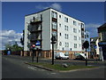
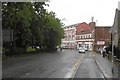
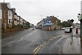
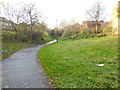
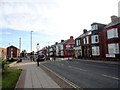
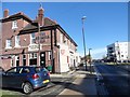
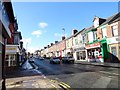
36 photos from this area
Area Information
Key information about the SR2 7PH including its size, population, and administrative classification.
- Area Type
- Postcode
- Area Size
- 7589 m²
- Population
- 1365
- Population Density
- 9440 people/km²
House Prices in SR2 7PH
45
Properties
£86,607
Average Sold Price
£12,500
Lowest Price
£195,000
Highest Price
Showing 45 properties
| Address | Type | Beds | Baths | Last Sale Price | Last Sale Date | |
|---|---|---|---|---|---|---|
| 17 Western Hill, Thornhill, Sunderland, SR2 7PH | Terraced | 4 | 2 | £84,000 | Jun 2023 | |
| 16 Western Hill, Thornhill, Sunderland, SR2 7PH | house | - | - | £84,000 | Jun 2023 | |
| 10 Western Hill, Thornhill, Sunderland, SR2 7PH | Flat | - | - | £100,000 | May 2023 | |
| 24 Western Hill, Thornhill, Sunderland, SR2 7PH | house | 3 | - | £86,000 | Jun 2022 | |
| 25 Western Hill, Thornhill, Sunderland, SR2 7PH | Terraced | 4 | 1 | £85,000 | Jul 2021 | |
| 27 Western Hill, Thornhill, Sunderland, SR2 7PH | Terraced | 6 | 7 | £195,000 | Feb 2021 | |
| 14 Western Hill, Thornhill, Sunderland, SR2 7PH | Flat | 5 | 2 | £108,000 | Aug 2015 | |
| 22 Western Hill, Thornhill, Sunderland, SR2 7PH | Terraced | - | - | £85,000 | Mar 2012 | |
| 15 Western Hill, Thornhill, Sunderland, SR2 7PH | house | - | - | £92,000 | Oct 2009 | |
| 6 Western Hill, Thornhill, Sunderland, SR2 7PH | Terraced | - | - | £60,000 | Mar 2008 |
Page 1 of 5
Energy Efficiency in SR2 7PH
Amenities
Schools
| Rank | School | Type | Entry gender | Ages |
|---|
Explore more schools in this area
Go to Schools tabDemographics
Household Size
Family (3-5 people)
most common
Accommodation Type
Houses
most common
Tenure
54
majority
Ethnic Group
White
most common
Religion
N/A
most common
Household Composition
N/A
most common
Age
47
median
Adults (30-64 years)
most common
Household Deprivation
N/A
with no deprivation
NS-SEC
24
in Lower managerial occupations
Explore more demographic insights in this area
Go to Demographics tabPlanning
Planning Constraints
- Flood RiskPremium
- Ramsar Wetland SitesPremium
- Area of Outstanding Natural BeautyPremium
- Protected Nature ReservePremium
- Protected WoodlandPremium