Area Overview for Hartburn
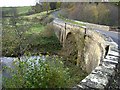
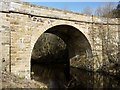
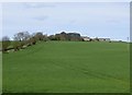
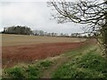
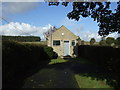
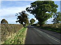
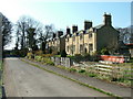
Photos of Hartburn

Area Information
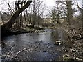
Living in Hartburn offers a distinct experience defined by its modest scale and quiet residential character. This district borough ward covers an area of 18.5 km², creating a compact community where daily commutes are likely managed with ease. The environment is shaped by specific natural constraints, most notably the presence of protected woodland which influences the landscape and potential development. Safety is a primary feature of life here, with the area demonstrating a crime risk score of 88 out of 100. This low risk rating confirms that Hartburn functions as a secure neighbourhood for families and individuals alike. You can expect a setting free from major environmental planning constraints such as Ramsar wetland sites or Areas of Outstanding Natural Beauty. However, the presence of protected woodland means some restrictions apply to future construction or land use changes. The community feels established rather than transient, reflecting a long-term resident population over short-term visitors. When you consider homes in Hartburn, you are choosing a location with a clear identity defined by its green spaces and low crime levels. This specific geography creates a lifestyle where the natural environment plays a central role in the neighbourhood fabric.
- Area Type
- Parish
- Area Size
- 18.5 km²
- Population
- Not available
- Population Density
- Not available
Demographics
The community within Hartburn is characterised by a significant shift toward older residents. The median age stands at 70 years, indicating that the majority of the population falls into the senior demographic. While specific data on the most common age range is recorded as total in the available records, the high median age suggests a retirement-focused locality. Home ownership levels are substantial, with 57% of residents owning their properties outright or with a mortgage. This figure reinforces the idea that Hartburn is a stable area for settled households rather than a hub for short-term rentals or student housing. Accommodation details are recorded generally, but the high ownership percentage implies a wealthier, established housing stock. The absence of specific ethnicity or religion data does not diminish the clear picture of an older, owner-occupied community. For those considering living in Hartburn, the demographic profile points toward a quiet life with many retirees. The household composition likely reflects larger homes adapted for elderly living or properties that have been in the same family for generations. This age structure creates a specific social dynamic where community groups often cater to adult amenities rather than youth-centric facilities.
Household Size
Accommodation Type
Tenure
Ethnic Group
Religion
Household Composition
Age
Household Deprivation
NS-SEC
Explore more demographic insights in this area
Go to Demographics tabPlanning
Planning Constraints
- Flood RiskPremium
- Ramsar Wetland SitesPremium
- Area of Outstanding Natural BeautyPremium
- Protected Nature ReservePremium
- Protected WoodlandPremium