Area Overview for NE8 4QT
Photos of NE8 4QT
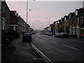
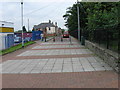
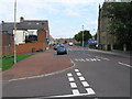
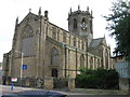
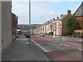
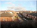
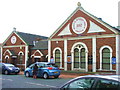
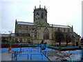
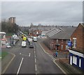
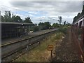
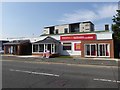
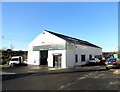
67 photos from this area
Area Information
Key information about the NE8 4QT including its size, population, and administrative classification.
- Area Type
- Postcode
- Area Size
- 6794 m²
- Population
- 1466
- Population Density
- 215781 people/km²
House Prices in NE8 4QT
41
Properties
£64,820
Average Sold Price
£13,500
Lowest Price
£102,000
Highest Price
Showing 41 properties
| Address | Type | Beds | Baths | Last Sale Price | Last Sale Date | |
|---|---|---|---|---|---|---|
| 116 Rawling Road, Bensham, Gateshead, NE8 4QT | Flat | - | - | £80,500 | Nov 2024 | |
| 157 Rawling Road, Bensham, Gateshead, NE8 4QT | Flat | - | - | £58,500 | Mar 2024 | |
| 169 Rawling Road, Bensham, Gateshead, NE8 4QT | Flat | 2 | - | £70,000 | Mar 2023 | |
| 118 Rawling Road, Bensham, Gateshead, NE8 4QT | Flat | 3 | 1 | £72,000 | Oct 2022 | |
| 151 Rawling Road, Bensham, Gateshead, NE8 4QT | Flat | - | - | £82,000 | Sep 2022 | |
| 147 Rawling Road, Bensham, Gateshead, NE8 4QT | Flat | - | - | £83,000 | Sep 2022 | |
| 149 Rawling Road, Bensham, Gateshead, NE8 4QT | Flat | 2 | - | £83,000 | Sep 2022 | |
| 153 Rawling Road, Bensham, Gateshead, NE8 4QT | Flat | 2 | - | £67,500 | Dec 2021 | |
| 120 Rawling Road, Bensham, Gateshead, NE8 4QT | Flat | - | - | £73,000 | Apr 2021 | |
| 110 Rawling Road, Bensham, Gateshead, NE8 4QT | Flat | - | - | £39,999 | Oct 2018 |
Page 1 of 5
Energy Efficiency in NE8 4QT
Amenities
Schools
| Rank | School | Type | Entry gender | Ages |
|---|
Explore more schools in this area
Go to Schools tabDemographics
Household Size
N/A
most common
Accommodation Type
N/A
most common
Tenure
N/A
majority
Ethnic Group
N/A
most common
Religion
N/A
most common
Household Composition
N/A
most common
Age
N/A
median
N/A
most common
Household Deprivation
N/A
with no deprivation
NS-SEC
N/A
in Lower managerial occupations
Explore more demographic insights in this area
Go to Demographics tabPlanning
Planning Constraints
- Flood RiskPremium
- Ramsar Wetland SitesPremium
- Area of Outstanding Natural BeautyPremium
- Protected Nature ReservePremium
- Protected WoodlandPremium