Area Overview for NE8 1XN
Photos of NE8 1XN
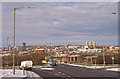
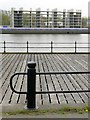
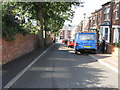
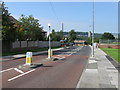
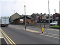
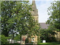
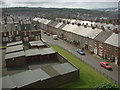
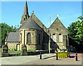
100 photos from this area
Area Information
Key information about the NE8 1XN including its size, population, and administrative classification.
- Area Type
- Postcode
- Area Size
- 8465 m²
- Population
- 1763
- Population Density
- 5170 people/km²
House Prices in NE8 1XN
54
Properties
£62,191
Average Sold Price
£12,500
Lowest Price
£138,000
Highest Price
Showing 54 properties
| Address | Type | Beds | Baths | Last Sale Price | Last Sale Date | |
|---|---|---|---|---|---|---|
| 27-29 Rectory Place, Bensham, Gateshead, NE8 1XN | house | - | - | £135,000 | Apr 2024 | |
| 2A Rectory Place, Bensham, Gateshead, NE8 1XN | Flat | 2 | 1 | £60,000 | Feb 2024 | |
| 20 Rectory Place, Bensham, Gateshead, NE8 1XN | Flat | - | - | £74,995 | Aug 2023 | |
| 13 Rectory Place, Bensham, Gateshead, NE8 1XN | Terraced | 3 | 1 | £70,000 | Oct 2022 | |
| 49 Rectory Place, Bensham, Gateshead, NE8 1XN | Flat | - | - | £38,000 | Oct 2020 | |
| 11 Rectory Place, Bensham, Gateshead, NE8 1XN | Terraced | 3 | - | £132,950 | Jan 2018 | |
| 17 Rectory Place, Bensham, Gateshead, NE8 1XN | house | - | - | £138,000 | Dec 2017 | |
| 51 Rectory Place, Bensham, Gateshead, NE8 1XN | Terraced | 3 | - | £76,000 | May 2015 | |
| 12 Rectory Place, Bensham, Gateshead, NE8 1XN | Flat | 2 | 1 | £50,000 | Mar 2014 | |
| 39 Rectory Place, Bensham, Gateshead, NE8 1XN | Flat | - | - | £30,000 | Jan 2014 |
Page 1 of 6
Energy Efficiency in NE8 1XN
Amenities
Schools
| Rank | School | Type | Entry gender | Ages |
|---|
Explore more schools in this area
Go to Schools tabDemographics
Household Size
One person
most common
Accommodation Type
Flats
most common
Tenure
27
majority
Ethnic Group
White
most common
Religion
N/A
most common
Household Composition
N/A
most common
Age
47
median
Adults (30-64 years)
most common
Household Deprivation
N/A
with no deprivation
NS-SEC
23
in Lower managerial occupations
Explore more demographic insights in this area
Go to Demographics tabPlanning
Planning Constraints
- Flood RiskPremium
- Ramsar Wetland SitesPremium
- Area of Outstanding Natural BeautyPremium
- Protected Nature ReservePremium
- Protected WoodlandPremium