Area Overview for NE8 1TF
Photos of NE8 1TF
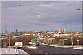
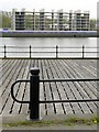
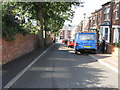
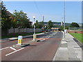
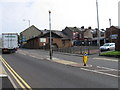
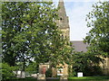
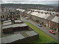
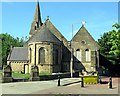
100 photos from this area
Area Information
Key information about the NE8 1TF including its size, population, and administrative classification.
- Area Type
- Postcode
- Area Size
- 5985 m²
- Population
- 1545
- Population Density
- 258145 people/km²
House Prices in NE8 1TF
24
Properties
£64,475
Average Sold Price
£42,950
Lowest Price
£86,000
Highest Price
Showing 24 properties
| Address | Type | Beds | Baths | Last Sale Price | Last Sale Date | |
|---|---|---|---|---|---|---|
| 52 Cotfield Walk, Bensham, Gateshead, NE8 1TF | Terraced | 3 | 1 | £86,000 | Jun 2018 | |
| 41 Cotfield Walk, Bensham, Gateshead, NE8 1TF | Flat | - | - | £42,950 | Dec 2003 | |
| 47 Cotfield Walk, Bensham, Gateshead, NE8 1TF | house | 3 | - | - | - | |
| 31 Cotfield Walk, Bensham, Gateshead, NE8 1TF | house | - | - | - | - | |
| 40 Cotfield Walk, Bensham, Gateshead, NE8 1TF | house | - | - | - | - | |
| 44 Cotfield Walk, Bensham, Gateshead, NE8 1TF | Terraced | - | - | - | - | |
| 35 Cotfield Walk, Bensham, Gateshead, NE8 1TF | Flat | - | - | - | - | |
| 46 Cotfield Walk, Bensham, Gateshead, NE8 1TF | Bungalow | - | - | - | - | |
| 53 Cotfield Walk, Bensham, Gateshead, NE8 1TF | Semi-detached | - | - | - | - | |
| 54 Cotfield Walk, Bensham, Gateshead, NE8 1TF | Bungalow | - | - | - | - |
Page 1 of 3
Energy Efficiency in NE8 1TF
Amenities
Schools
| Rank | School | Type | Entry gender | Ages |
|---|
Explore more schools in this area
Go to Schools tabDemographics
Household Size
N/A
most common
Accommodation Type
N/A
most common
Tenure
N/A
majority
Ethnic Group
N/A
most common
Religion
N/A
most common
Household Composition
N/A
most common
Age
N/A
median
N/A
most common
Household Deprivation
N/A
with no deprivation
NS-SEC
N/A
in Lower managerial occupations
Explore more demographic insights in this area
Go to Demographics tabPlanning
Planning Constraints
- Flood RiskPremium
- Ramsar Wetland SitesPremium
- Area of Outstanding Natural BeautyPremium
- Protected Nature ReservePremium
- Protected WoodlandPremium