Area Overview for NE65 8UU
Photos of NE65 8UU
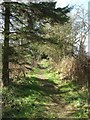
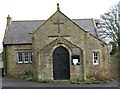
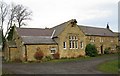
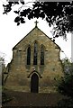
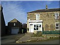
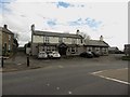
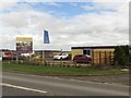
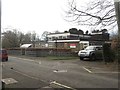
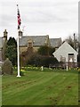
48 photos from this area
Area Information
Key information about the NE65 8UU including its size, population, and administrative classification.
- Area Type
- Postcode
- Area Size
- 2.8 hectares
- Population
- 1680
- Population Density
- 23 people/km²
House Prices in NE65 8UU
10
Properties
£561,667
Average Sold Price
£260,000
Lowest Price
£955,000
Highest Price
Showing 10 properties
| Address | Type | Beds | Baths | Last Sale Price | Last Sale Date | |
|---|---|---|---|---|---|---|
| The Old Vicarage, Drummonds Close, Longhorsley, NE65 8UU | Detached | 6 | 3 | £955,000 | Aug 2022 | |
| School House, Road From U 6022 To Longhorsley West Road, Longhorsley, NE65 8UU | Semi-detached | - | - | £470,000 | Aug 2016 | |
| Glen View, Road From U 6022 To Longhorsley West Road, Longhorsley, NE65 8UU | house | - | - | £260,000 | Apr 2016 | |
| St Helens Vicarage, Drummonds Close, Longhorsley, NE65 8UU | house | - | - | - | - | |
| South Rigg, Road From U 6022 To Longhorsley West Road, Longhorsley, NE65 8UU | Detached | - | - | - | - | |
| Ivy Cottage, Road From U 6022 To Longhorsley West Road, Longhorsley, NE65 8UU | Semi-detached | 2 | - | - | - | |
| Colli-linn, Road From U 6022 To Longhorsley West Road, Longhorsley, NE65 8UU | Detached | - | - | - | - | |
| Haining Gate, Road From U 6022 To Longhorsley West Road, Longhorsley, NE65 8UU | Detached | - | - | - | - | |
| Beacon View, Road From U 6022 To Longhorsley West Road, Longhorsley, NE65 8UU | Bungalow | 2 | - | - | - | |
| Braefoot, Road From U 6022 To Longhorsley West Road, Longhorsley, NE65 8UU | Detached | - | - | - | - |
Energy Efficiency in NE65 8UU
Amenities
Schools
| Rank | School | Type | Entry gender | Ages |
|---|
Explore more schools in this area
Go to Schools tabDemographics
Household Size
Two person
most common
Accommodation Type
Houses
most common
Tenure
80
majority
Ethnic Group
White
most common
Religion
N/A
most common
Household Composition
N/A
most common
Age
47
median
Adults (30-64 years)
most common
Household Deprivation
N/A
with no deprivation
NS-SEC
47
in Lower managerial occupations
Explore more demographic insights in this area
Go to Demographics tabPlanning
Planning Constraints
- Flood RiskPremium
- Ramsar Wetland SitesPremium
- Area of Outstanding Natural BeautyPremium
- Protected Nature ReservePremium
- Protected WoodlandPremium