Area Overview for NE61 1BY
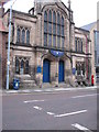
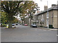
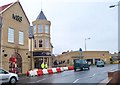
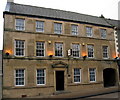
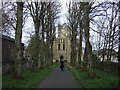
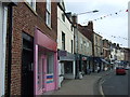
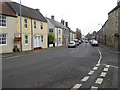
Photos of NE61 1BY

Area Information
NE61 1BY is a small, densely populated residential cluster in England, covering just 2876 m² and home to 1454 people. With a population density of over 505,000 people per square kilometre, the area is compact but packed with residents. This postcode is notable for its elderly demographic, with the majority of residents aged 65 and above. Daily life here is shaped by proximity to local amenities, including retail outlets and rail connections. The area’s size means it is likely to feel intimate, with a focus on community interaction. However, the high density also suggests limited space for expansion or new developments. For buyers, the challenge lies in balancing the area’s compact nature with its accessibility to nearby services and transport links. Living in NE61 1BY means prioritising convenience over space, with a strong emphasis on local infrastructure and connectivity.
- Area Type
- Postcode
- Area Size
- 2876 m²
- Population
- 1454
- Population Density
- 2679 people/km²
The property market in NE61 1BY is characterised by a high rate of home ownership (59%) and a predominance of houses as the accommodation type. This suggests a market where many properties are owner-occupied, though the remaining 41% may be rented out, potentially offering opportunities for investors. The small size of the area means the housing stock is limited, with a focus on existing homes rather than new developments. Buyers should consider the compact nature of the postcode, as expansion is unlikely. The presence of houses may appeal to families or those seeking more space, though the high population density could mean limited availability. For those prioritising proximity to amenities and transport, the area’s immediate surroundings offer practical advantages, but the small footprint means competition for available properties.
House Prices in NE61 1BY
No properties found in this postcode.
Energy Efficiency in NE61 1BY
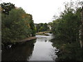
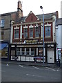
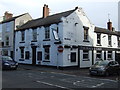
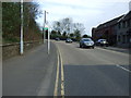
The lifestyle in NE61 1BY is shaped by its proximity to essential amenities. Retail options include Morrisons Daily, M&S Morpeth, and Iceland Morpeth, offering a range of shopping needs within reach. Rail stations such as Morpeth and Pegswood provide access to broader transport networks, supporting both daily commutes and leisure travel. While the area lacks large-scale leisure facilities, the compact layout ensures that residents can access shops, dining, and transport without long journeys. The presence of multiple rail stations and retail outlets suggests a practical, convenience-focused lifestyle. However, the limited space of the postcode means that larger parks or recreational areas may be located further away, requiring residents to plan accordingly for outdoor activities.
Amenities
Schools
Residents of NE61 1BY have access to two primary schools: St Robert’s Roman Catholic Voluntary Aided First School and St Roberts Catholic First School, Morpeth. Both institutions cater to younger children, with the latter operating as an academy. The presence of two schools within practical reach provides families with options, though the data does not specify Ofsted ratings or academic performance. The mix of school types may offer different educational approaches, with the academy potentially offering specialised curricula or governance structures. For parents, the proximity of these schools is a key consideration, especially for those prioritising early education. However, the absence of secondary schools in the data means families may need to look further afield for comprehensive schooling.
| Rank | School | Type | Entry gender | Ages |
|---|
Explore more schools in this area
Go to Schools tabDemographics
The community in NE61 1BY is predominantly elderly, with a median age of 47 and the most common age range being 65+. This suggests a population that may have retired or downsized, with a focus on established, long-term residents. Home ownership is relatively high at 59%, indicating a stable housing market where many properties are owner-occupied. The accommodation type is primarily houses, which, combined with the ownership rate, implies a mix of family homes and private residences. The predominant ethnic group is White, reflecting a homogenous demographic profile. With 1454 residents in a small area, the community is likely tightly knit, though the high population density may impact living space and privacy. The data does not indicate significant deprivation, but the elderly demographic may have specific needs related to healthcare and mobility.
Household Size
Accommodation Type
Tenure
Ethnic Group
Religion
Household Composition
Age
Household Deprivation
NS-SEC
Explore more demographic insights in this area
Go to Demographics tabPlanning
Planning Constraints
- Flood RiskPremium
- Ramsar Wetland SitesPremium
- Area of Outstanding Natural BeautyPremium
- Protected Nature ReservePremium
- Protected WoodlandPremium