Area Overview for NE6 2TB
Photos of NE6 2TB
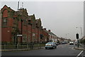
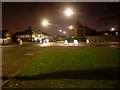
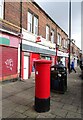
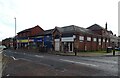
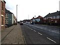
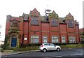
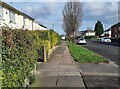
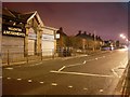
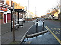
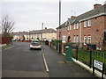
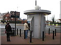
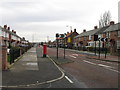
23 photos from this area
Area Information
Key information about the NE6 2TB including its size, population, and administrative classification.
- Area Type
- Postcode
- Area Size
- 7540 m²
- Population
- 1674
- Population Density
- 222002 people/km²
House Prices in NE6 2TB
29
Properties
£82,711
Average Sold Price
£37,500
Lowest Price
£115,000
Highest Price
Showing 29 properties
| Address | Type | Beds | Baths | Last Sale Price | Last Sale Date | |
|---|---|---|---|---|---|---|
| 69 Norbury Grove, Byker, Newcastle Upon Tyne, NE6 2TB | Semi-detached | 2 | 1 | £115,000 | Mar 2025 | |
| 60 Norbury Grove, Byker, Newcastle Upon Tyne, NE6 2TB | house | 3 | 1 | £107,000 | May 2024 | |
| 56 Norbury Grove, Byker, Newcastle Upon Tyne, NE6 2TB | house | - | - | £100,000 | May 2023 | |
| 57 Norbury Grove, Byker, Newcastle Upon Tyne, NE6 2TB | house | - | - | £109,950 | Apr 2022 | |
| 87 Norbury Grove, Byker, Newcastle Upon Tyne, NE6 2TB | house | - | - | £90,000 | Jan 2021 | |
| 65 Norbury Grove, Byker, Newcastle Upon Tyne, NE6 2TB | house | - | - | £77,500 | Nov 2016 | |
| 77 Norbury Grove, Byker, Newcastle Upon Tyne, NE6 2TB | house | - | - | £57,500 | Jan 2016 | |
| 71 Norbury Grove, Byker, Newcastle Upon Tyne, NE6 2TB | Terraced | - | - | £37,500 | Nov 2002 | |
| 42 Norbury Grove, Byker, Newcastle Upon Tyne, NE6 2TB | Semi-detached | - | - | £49,950 | Oct 2002 | |
| 91 Norbury Grove, Byker, Newcastle Upon Tyne, NE6 2TB | Semi-detached | - | - | - | - |
Page 1 of 3
Energy Efficiency in NE6 2TB
Amenities
Schools
| Rank | School | Type | Entry gender | Ages |
|---|
Explore more schools in this area
Go to Schools tabDemographics
Household Size
One person
most common
Accommodation Type
Houses
most common
Tenure
25
majority
Ethnic Group
White
most common
Religion
N/A
most common
Household Composition
N/A
most common
Age
47
median
Adults (30-64 years)
most common
Household Deprivation
N/A
with no deprivation
NS-SEC
12
in Lower managerial occupations
Explore more demographic insights in this area
Go to Demographics tabPlanning
Planning Constraints
- Flood RiskPremium
- Ramsar Wetland SitesPremium
- Area of Outstanding Natural BeautyPremium
- Protected Nature ReservePremium
- Protected WoodlandPremium