Area Overview for NE40 4EA
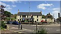
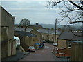
Photos of NE40 4EA

Area Information
NE40 4EA is a small, tightly knit residential area in England, covering just 1.9 hectares and home to 1,710 people. Its compact size means it’s a quiet, community-focused place, with a population density of 1,369 people per square kilometre. This suggests a mix of closely spaced homes and shared spaces, ideal for those seeking a manageable, localised environment. The area’s proximity to retail, rail, and metro services ensures residents have access to essentials without needing to travel far. Daily life here is characterised by convenience and practicality, with amenities like Co-op stores and nearby stations offering easy access to shopping, transport, and regional connections. The low flood risk and absence of protected natural sites mean development is straightforward, though the area remains unassuming rather than sprawling. For buyers, NE40 4EA offers a compact, functional living space with a strong emphasis on accessibility, making it suitable for those prioritising proximity to services over expansive landscapes.
- Area Type
- Postcode
- Area Size
- 1.9 hectares
- Population
- 1710
- Population Density
- 1369 people/km²
The property market in NE40 4EA is dominated by owner-occupied homes, with 80% of properties owned by residents rather than rented. This high home ownership rate points to a community of long-term residents, many of whom may have lived in the area for years. The accommodation type is predominantly houses, which contrasts with areas where flats or apartments dominate. This suggests a focus on traditional, standalone homes, likely appealing to those prioritising space and privacy. Given the area’s small size, the housing stock is limited, meaning buyers should consider the immediate surroundings for additional options. The compact nature of NE40 4EA may also mean properties are in close proximity to each other, fostering a tight-knit community feel. For buyers, this area offers a chance to invest in a stable, owner-occupied market with a clear emphasis on family-friendly, single-dwelling homes.
House Prices in NE40 4EA
Showing 26 properties
| Address | Type | Beds | Baths | Last Sale Price | Last Sale Date | |
|---|---|---|---|---|---|---|
| 9 Mount View, Crawcrook, Ryton, NE40 4EA | Terraced | 2 | 2 | £132,000 | Oct 2025 | |
| 10 Mount View, Crawcrook, Ryton, NE40 4EA | Terraced | 3 | 1 | £139,000 | Sep 2025 | |
| 26 Mount View, Crawcrook, Ryton, NE40 4EA | Terraced | 3 | - | £57,000 | Apr 2025 | |
| 24 Mount View, Crawcrook, Ryton, NE40 4EA | Terraced | 2 | 1 | £128,000 | Nov 2024 | |
| 8 Mount View, Crawcrook, Ryton, NE40 4EA | house | - | - | £110,000 | Sep 2024 | |
| 25 Mount View, Crawcrook, Ryton, NE40 4EA | Terraced | 3 | 2 | £135,000 | Sep 2024 | |
| 18 Mount View, Crawcrook, Ryton, NE40 4EA | Terraced | 3 | 1 | £135,000 | Dec 2022 | |
| 1 Mount View, Crawcrook, Ryton, NE40 4EA | house | 3 | - | £115,000 | Jul 2021 | |
| 5 Mount View, Crawcrook, Ryton, NE40 4EA | Terraced | 2 | 1 | £105,000 | Sep 2020 | |
| 19 Mount View, Crawcrook, Ryton, NE40 4EA | Terraced | 2 | - | £112,000 | Aug 2017 |
Energy Efficiency in NE40 4EA
Living in NE40 4EA offers a range of nearby amenities within practical reach. Retail options include Morrisons Daily and Co-op stores at Crawcrook and Ryton, providing everyday shopping needs. For transport, the area is served by five rail stations, including Wylam and Blaydon, as well as three metro stops like Bank Foot and Kingston Park, facilitating easy travel to surrounding areas. While the data does not specify parks or leisure facilities, the absence of protected natural sites suggests open spaces may be limited. However, the concentration of retail and transport hubs implies a lifestyle focused on convenience and accessibility. Residents can enjoy a mix of local shopping, efficient commuting, and the practicality of nearby services, making daily life in NE40 4EA both functional and straightforward.
Amenities
Schools
| Rank | School | Type | Entry gender | Ages |
|---|
Explore more schools in this area
Go to Schools tabDemographics
The community in NE40 4EA is predominantly middle-aged, with a median age of 47 and the most common age range being adults aged 30–64. This suggests a stable population, likely with established careers and families. Home ownership is high at 80%, indicating a strong presence of long-term residents rather than transient renters. The area is largely composed of houses, reflecting a preference for standalone properties over flats or apartments. The predominant ethnic group is White, though no specific data on diversity or deprivation levels is provided. The population density of 1,369 people per square kilometre implies a mix of family homes and smaller households, creating a balanced but closely packed community. This density may influence local dynamics, fostering neighbourly interactions while requiring efficient use of space. The age profile suggests a focus on practical living, with fewer young families or retirees compared to other areas.
Household Size
Accommodation Type
Tenure
Ethnic Group
Religion
Household Composition
Age
Household Deprivation
NS-SEC
Explore more demographic insights in this area
Go to Demographics tabPlanning
Planning Constraints
- Flood RiskPremium
- Ramsar Wetland SitesPremium
- Area of Outstanding Natural BeautyPremium
- Protected Nature ReservePremium
- Protected WoodlandPremium